|
DOCTOR
DISK |
| Contact Details |
 |
| For Data Recovery see DriveSavers and quote Reseller ID# DS12600 to receive a discount |
| Current Virus Information |
| Virus Tracking Page |
| Price Lists |
| Family PC Series |
| Upgrade Prices |
| Services |
| Information |
| Warranty Information |
| About the Company |
| About Phil Smith |
| Motorbikes and
Sidecars Chang Jiang 750, CJ750 |
| Statement of Faith |
| Family Photographs |
| Journey to the West |
| Phil's Resume |
| ACA, ACoA, Adult Children |
| Adoptive Families of Hong Kong |
| Hot Pages |
 |
| Phil's Typhoon Page |
| Handy HK Links |
| Back to Home Page |
 |
31/10/98  |
Hurricane Frances ... Florida, USA ... 4th September 2004
Hurricane Frances was on 3rd September, still forecast to strike Florida on the afternoon of Saturday 4th September 2004 Local time (EST = GMT - 4 hours )
Current information on Tropical Storms World-wide:
As early as 24th August, Jim Leonard mentioned
to the Tropical Cyclones Discussion Group a tropical disturbance that had
been noticed in the Eastern Atlantic not far from Africa. By 26th
August Tropical Storm Frances had been named and was approaching hurricane
strength. At this stage the storm was still listed on my web site as
"no threat to land." I changed this to "no immediate threat to land"
when the models started forecasting a possible approach towards Bahamas
and Florida about a week in advance. In a week, a tropical cyclone
can decide to do almost anything it wants, despite our best efforts at
forecasting. By 28th August, I was simultaneously tracking no fewer than
ten active tropical cyclones on my page ... an all-time record! I
rapidly knocked off four of them as they decayed and changed my notation
on Frances to "towards Bahamas and Florida" with orange colouring which
always denotes that this cyclone is no immediate threat to populated
areas. As the discussion and forecasts showed landfall more and more
likely, I changed the notation to red colouring which always means that
this cyclone is potentially dangerous to populated areas.
In the late
evening of Friday 3rd September, I decided to commence a web page - this
one - to record al sorts of interesting facts about Frances as she
approached Florida. I shall endeavour to keep this page as
up-to-date as possible during the next few days as Frances reaches and
crosses Florida. It seems that prayer is being answered as I type on
the morning of 4th September, as Frances has weakened from a powerful
Category Four Hurricane which was forecast to intensify to Category Five
on Friday to a much less powerful Category Two this morning.
As you may
gather from the e-mails and forecast maps, Frances stalled just off the
coast until Sturday evening and then moved across the peninsula during
Saturday night and all day Sunday. According to TV broadcasts,
insurance compamies estimated the damage done on the peninsula to be in
excess of USD$10 billion. The storm failed to fully regain Hurricane
strenght over the Gulf and was still a Tropical Storm as it crossed the
Panhandle into SW Georgia - SE Alabama area where warnings were
discontinued.
News Links:
CNN: Downgraded
Frances moves into Georgia 7 Sep 2004
CNN: Flooding,
long lines in Frances' wake 7 Sep 2004
CNN: Riding
out Frances 5 Sep 2004
BBC: Rescue flights leave for
Florida 7 Sep 2004
BBC: Hurricane loss
"less than feared" 7 Sep 2004
BBC: Hurricane
Frances "still a risk" 6 Sep 2004
Palm Beach Post: Frances
6 Sep 2004
E-mail History of Frances
I have compiled a selection of some of the e-mails in which Frances has
been discussed by experts and amateur enthusiasts alike. Sometimes
you can read also about some of the simultaneous tropical cyclones which
were active during the long life of Frances. Occasionally I have
cut irrelevant or personal sections out of e-mails, denoted by [snip], and
I think I have inserted a comment of my own somewhere, denoted by
[Editor:...].
Enjoy!
From: Jim Leonard To: Typhoon Gang TCDG
Date:
08/24/2004 12:12 Subject: New Atlantic system.
It looks
like the Atlantic basin is about to get some action again soon. The
disturbance out at around 10N and 29W appears to be well on its way to
become the next tropical storm or hurricane. Conditions ahead of it look
quite favorable. This could be one of those all the way across the
Atlantic type tracks we would expect this time of the season.
Jim
From: Matt Crowther To: TCDG
Date: 08/24/2004
14:14 Subject: Re: New Atlantic system.
On
Aug 24, 2004, at 12:12 AM, Jim Leonard wrote:
> It looks like the
Atlantic basin is about to get some action again soon. The disturbance out
at around 10N and 29W appears to be well on its way to become the next
tropical storm or hurricane. Conditions ahead of it look quite favorable.
This could be one of those all the way across the Atlantic type tracks we
would expect this time of the season.
> Jim
We shall see
if this one actually makes it all the way across- the main models have
been saying no, including the latest GFDL.
Matt
From: "Jose Garcia" To: TCDG
Date: 08/24/2004
23:07 Subject: RE: New Atlantic system.
Hi to
all... Even though the GFS turns this system NW lets see if this forecast
becomes a reality because conditions seem to be more favorable for a more
westerly track in the next few days, NOGAPS seems to keep this system at a
lower latitude in a track more towards the W-WNW. Lets see how this
disturbance develops and moves across the area and also there are two or
three more systems forecasted to develop after this one so a more active
period coming as typical getting to the peak of the ATL season...
Stay
tuned
>From: Jim Leonard To: Typhoon Gang
>Subject: New Atlantic system. Date: Tue, 24 Aug 2004
00:12:22 -0400
>It looks like the Atlantic basin is about to get
some action again soon. The disturbance out at around 10N and 29W
appears to be well on its way to become the next tropical storm or
hurricane.
>Conditions ahead of it look quite favorable. This could
be one of those all the way across the Atlantic type tracks we would
expect this time of the season.
>Jim
From: "Jose Garcia" To: TCDG
Date: 08/26/2004
18:27 Subject: Frances now stronger 60mph
Hi to
all...
Tropical storm Frances is now getting closer to hurricane
strenght as it moves WNW17mph and gets closer to the islands, want to poin
out that every model has been moving farther west this system in every new
run so this means they bring this cyclone closer to the Northern Leeward
Islands as time goes by, this was also pointed by Lixion Avila of NHC in
the 5am 0900Z discussion.
We'll have to watch this system closely in
the Caribbean because it may turn more to the west later in the period
which could bring this system towards us as the ridge gets stronger. The
system continues to have some light easterly shear which means that high
its still pushing it in a more W track. So now that winds are estimated at
60mph they may already be upped to 65 or 70mph in the next advisory or
even upgraded to hurricane strenght lets see how this difference in the
forecast models ends...
Stay tuned
From: "Jose Garcia" To: TCDG
Date: 08/26/2004
22:26 Subject: TS Frances nearing hurricane
strenght
hi to all...
Tropical storm Frances is now nearing
hurricane strenght and it has now moved more westward in the past hours
and is developing an eye as it continues in rather favorable conditions
for intensification. The models continue to be in no agreement about the
future track of this storm so still the islands have a great chance to be
hitted by this hurricane as it is now a classic Cape Verde track. Lixion
Avila pointed out this posibility in the 5am 0900Z discussion about
Frances. So we´ll have to watch this very carefully in the islands as TS
Frances is about to become a hurricaneas it continues in that westward
track...
stay tuned
From: Roger Edson To: TCDG
Date: 08/26/2004 22:46 Subject:
Re: JMA increased CHABA's winds to 110 knots!!! and almost Hur
Frances
Karl,
Very nice summary.
BTW, Looks like
Frances, indeed will soon be a hurricane as it has now developed a partial
85h eye.
Roger
From: Jim Leonard To: TCDG
Date: 08/27/2004
13:15 Subject: Re: Georgette and TS 21W
Good One!
I
see the 00Z gfs is bringing Frances on a track similar to Georges six
years ago, could be an interesting week here next
week.
Jim
Roger Edson wrote:
>You can see the green
best if you wear prescription goggles...
>roger
>---
Jim Leonard wrote:
>>Roger
>>Do you remember the
last time you saw over 80 inches of rain during a three month period? I
see Guam is over 30 inches for August combined with 10 last month and
nearly 40 inches in June it should be really green there in
Guam.
>>Jim
From: "Eric Blake" To: TCDG
Date: 08/27/2004
13:44 Subject: actually..
all models have shifted left
in the 00z run... nogaps, ukmet, gfs, cmc. the ukmet is left by 1.5 deg s
and 3.4 deg w! wow.. of course in 7 days it is still a long ways away from
florida but on this track.. way too close for
comfort!
Eric
>From: Jim Leonard To:
TCDG
>Subject: Re: Georgette and TS 21W Date: Fri, 27 Aug 2004
01:15:18 -0400
>Good One!
>I see the 00Z gfs is bringing
Frances on a track similar to Georges six years ago, could be an
interesting week here next week.
>Jim
From: Matt Crowther To: TCDG
Date: 08/29/2004
04:29 Subject: Gaston and Frances
Vortex fix on Gaston
shows 996mb and 59 kts- looks much better on satellite and radar the past
3 hours. I think this could become a hurricane, as it is not moving much
right now.
Frances looks awesome on the sat- and the models are now
converging on a south FL threat in about a week, then maybe from there
into the Gulf.
Then we have the other disturbance south of Bermuda
which could easily be classified as a TD at 5PM.
Wow- what an
August!
Matt
From: "Gary Padgett" To: TCDG
Date: 08/29/2004
04:59 Subject: Re: Gaston and Frances
>
Wow- what an August!
> Matt
That's the understatement of
the year!!!!!!
As of right now, there've been 19 NS (counting TS-21W)
in the NH since Alex was named on 1 August. I'm pretty sure that's a
record number of NS in any month since I started writing the TC summaries
almost 7 yrs ago.
Gaston is the 7th Atlantic NS for August, tying 1933
and 1995, and an 8th one is certainly not out of the question as the LOW
east of Gaston slowly becomes better organized.
From: "Gary Padgett" To: TCDG
Date: 08/29/2004
05:07 Subject: Re: Gaston and Frances
Further
comments on Matt's message:
> Frances looks awesome on the
sat- and the models are now converging on a south FL threat in about a
week, then maybe from there into the Gulf.
Really interesting
to speculate on just what Frances might do. If it does impact S Fla as the
models are suggesting, and nothing happens to weaken it, Frances could
turn out to be one of the truly great historical S Fla hurricanes on the
order of 1926, 1928, Donna or Andrew.
Another thing which is very
interesting is the pattern of WestPac activity lately, with the primary
area of formation shifting east to the Marshall Islands. This is more
typical of El Nino years.
Wonder if that's a harbinger of an El Nino
coming soon????
From: "Konon, Boris" To: TCDG
Date: 08/29/2004
05:08 Subject: RE: Gaston and Frances
If the
disturbance S of Bermuda becomes a named storm before the end of the
month, we will tie the record for the most number of named storms (8) to
form in one month in the Atlantic basin. The record of 8 was just set only
2 years ago in Sept!
With Charley's impact still fresh in everyone's
mind, I can see the media hype for Frances going through the roof,
especially if Florida ends up being the
target.
Boris
-----Original Message-----
From: Matt
Crowther Sent: Saturday, August 28, 2004 4:29 PM
To:
TCDG Subject: Gaston and Frances
Vortex fix on Gaston shows
996mb and 59 kts- looks much better on satellite and radar the past 3
hours. I think this could become a hurricane, as it is not moving much
right now.
Frances looks awesome on the sat- and the models are now
converging on a south FL threat in about a week, then maybe from there
into the Gulf.
Then we have the other disturbance south of Bermuda
which could easily be classified as a TD at 5PM.
Wow- what an
August!
Matt
From: Fu Dickson To: TCDG
Date: 08/29/2004
05:23 Subject: Re: Gaston and Frances
Hi all,
I
thought nobody cares about Gaston until I received this.
Strange. I
couldn't see any headline about Gaston at CNN, Foxnews and etc. Will it
pose any threat when it makes landfall in South Carolina? Or, it is simply
because the media turn the focus on olympic, especially the "Dream Team"
and the disappointing athletics team.
Cheers, Dickson Fu,
Hong Kong
Matt Crowther wrote:
Vortex fix on Gaston
shows 996mb and 59 kts- looks much better on satellite and radar the past
3 hours. I think this could become a hurricane, as it is not moving much
right now.
Frances looks awesome on the sat- and the models are now
converging on a south FL threat in about a week, then maybe from there
into the Gulf.
Then we have the other disturbance south of Bermuda
which could easily be classified as a TD at 5PM.
Wow- what an
August!
Matt
From: "Konon, Boris" To: TCDG
Date: 08/29/2004
05:26 Subject: RE: Gaston and Frances
For the 1926
Miami hurricane, if I remember correctly, adjusted for inflation and the
build up over the decades in the Miami area, the damage in 2000 dollars
for the same hurricane would be on the order of nearly 90 billion dollars.
That just boggles the mind.
Boris
-----Original
Message-----
From: Gary Padgett Sent: Saturday, August 28, 2004
5:08 PM
To: TCDG Subject: Re: Gaston and Frances
Further
comments on Matt's message:
> Frances looks awesome on the
sat- and the models are now converging on a south FL threat in about a
week, then maybe from there into the Gulf.
Really interesting
to speculate on just what Frances might do. If it does impact S Fla as the
models are suggesting, and nothing happens to weaken it, Frances could
turn out to be one of the truly great historical S Fla hurricanes on the
order of 1926, 1928, Donna or Andrew.
Another thing which is very
interesting is the pattern of WestPac activity lately, with the primary
area of formation shifting east to the Marshall Islands. This is more
typical of El Nino years.
Wonder if that's a harbinger of an El Nino
coming soon????
From: Ethan Henley To: TCDG
Date: 08/29/2004
09:05 Subject: Re: Gaston and Frances
Hi, All,
WOW!
What an Aug. , 7 possibly 8 TC in one month thats amazing. Frances looks
awsome and Gaston is looking more impressive.
WOW!
B/R Ethan
From: Jim Leonard To: Typhoon Gang
Date:
08/29/2004 14:09 Subject: ukmet
I see the latest
00Z ukmet shows a scary scenario for Florida. The model takes Frances over
Miami to just north of Naples to just offshore Tampa in a recurving
path.
Jim
From: "Phil Smith" To: austpacwx
Date:
08/29/2004 19:24 Subject: Re: [austpacwx] Wow and Bigger
Wow!
Hi Bussie and all,
Check out the Northern Hemisphere
for Tropical Cyclones.
Yesterday I was tracking ten storms
simultaneously on my page at http://www.drdisk.com.hk/cyclones.htm
but I have dropped off three storms yesterday when they got below 25 Knots
and another one today, so now I only have six on the page.
We have had
16 or 17 named storms for August so far, maybe more ... I haven't kept
count that carefully - too busy typing up all the HTML.
The current
ukmet model shows Hurricane Frances making a direct hit on Miami late this
week, then passing just North of Naples and then making a direct hit on
Tampa after recurving over the Gulf.
Typhoon Chaba, nearing Kyushu,
Japan, has an eye of 100 NM and 50 Knot winds out to 300 NM radius in all
directions. Its outer rainbands are currently covering South Korea,
Kyushu, Shikoku, almost all of Honshu, Taiwan, Okinawa, Ryukyu Is, and NE
Philippines. The total storm is thus well over 1200 km in diameter maybe
over 2000 km. Talk of shades of "The Day After Tomorrow"!
Meanwhile
here in Hong Kong we have Tropical Depression AERE (ex-20W) sitting
directly over us and emptying the heavens upon us. Nearly got drowned
going to Church this morning. So far today the observatory here has
hoisted Thunderstorm Warnings, Rainstorm Warnings, Flooding Warnings and
Landslip Warnings.
The river outside my window looks like milk coffee
because of all the soil being washed down. Check http://www.hko.gov.hk/wxinfo/rainfall/isohyet_p24e.shtml
for our 24-hour isohyet chart.
I'd be more than glad to share some of
this downpour with you guys in Oz if only we could figure out a way to tow
this cloud mass down there.
Phil
<><
From: "Tony Langdon, VK3JED" To: austpacwx
Date:
08/29/2004 20:08 Subject: Re: [austpacwx] Wow and Bigger
Wow!
At 09:24 PM 29/08/2004, you wrote:
>Hi Bussie and
all,
>Check out the Northern Hemisphere for Tropical Cyclones.
>Yesterday I was tracking ten storms simultaneously on my page at
http://www.drdisk.com.hk/cyclones.htm
but I have dropped off three storms yesterday when they got below 25 Knots
and another one today, so now I only have six on the page.
WOAH!
:-)
Well, I'm just firing up systems here for Tropical Storm Gaston,
and we're all keeping an eye on Frances for late next week. The irony is
that I am scheduled to do a talk at the local radio club on my activities
with Charley - there seems a good chance Frances might cause that to be
postponed!!!
Such is life. :)
73 de VK3JED http://vkradio.com/
From: "Paul Yole" To: austpacwx
Date: 08/29/2004
20:27 Subject: RE: [austpacwx] Wow and Bigger Wow!
Lets
hope not Tony.
I've been tracking Frances since early development and
with it's current intensity, if it makes landfall, there is going to be
some major destruction. Already rated as a Category 4 hurricane, Frances
is looking at even becoming a Category 5 over the next few
days.
Talking with fellow US chasers, we are looking at Frances
possibly turning more to the NW after it crosses the Bermuda area and
heading up the coast towards Northern Florida, but that is still too early
at this stage to know. But a majority agreed that if this happened, that
SC would probably bear the brunt of a landfall.
For those that are
wondering what is happening, I've uploaded a screen capture from my
hurricane tracking software at HYPERLINK http://www.lexicon.net/yolestorm/hurricane/US.GIF
Image was uploaded @ 22:25
Hopefully this one will stay away
from SW Fl and my fiance and son.
PaulY
From: "Tony Langdon, VK3JED" To: austpacwx
Date:
08/29/2004 20:42 Subject: RE: [austpacwx] Wow and Bigger
Wow!
At 10:27 PM 29/08/2004, you wrote:
>Lets
hope not Tony.
>I've been tracking Frances since early development
and with it's current intensity, if it makes landfall, there is going to
be some major destruction. Already rated as a Category 4 hurricane,
Frances is looking at even becoming a Category 5 over the next few
days.
That's my view exactly. SST's look quite high and the
path is almost entirely water, which means conditions are ripe for
intensification. The more immediate issue is Tropical Storm Gaston. I've
already activated some systems for that event, but Frances is the more
worrying one. I don't like the look of Frances, something bugging me about
that storm. Hope I'm wrong.
> Talking with fellow US chasers,
we are looking at Frances possibly turning more to the NW after it crosses
the Bermuda area and heading up the coast towards Northern Florida, but
that is still too early at this stage to know. But a majority agreed that
if this happened, that SC would probably bear the brunt of a
landfall.
The models are mixed with some saying FL, others
saying SC. Some of the guys on the Skywarn Net this morning made
comparisons between Frances and Andrew.
73 de VK3JED http://vkradio.com/
From: "Paul Yole" To: austpacwx
Date: 08/29/2004
21:06 Subject: RE: [austpacwx] Wow and Bigger
Wow!
Agreed Tony.
Frances has been bugging me too, and it
is a similar path to what Andrew took. I've taken a screenshot of the
similarities between Andrew's path and Frances' forecast path... Both
quite similar at the moment, although Andrew took a more northerly bend
than Frances is forecast too, but it wouldn't take too much to bend out
west and make a dash for Miami and Southern Florida again.
The
screenshot is at HYPERLINK http://www.lexicon.net/yolestorm/hurricane/AndrewFrances.GIF
Fortunately Gaston isn't going to be a major hurricane, but with the
advent of Charley not too long ago, the area is still suffering Charley's
after effects. Some major flooding could well follow.
Hopefully Gaston
remains below Category 1 levels, although the forecast is for it to make
the bare minimums for a Cat 1.
PaulY
From: "Phil Smith" To: TCDG
Date: 08/29/2004
21:41 Subject: Fwd: RE: [austpacwx] Wow and Bigger
Wow!
Hi all,
This thread from one of my other groups has a
link to an interesting comparison of the paths of Frances and
Andrew.
http://www.lexicon.net/yolestorm/hurricane/AndrewFrances.GIF
Tony is a ham radio operator as well as a weather enthusiast and he
works the "graveyard shift" co-ordinating rescue operations when
hurricanes
strike the US coast.
Phil
<><
From: Fu Dickson To: TCDG
Date: 08/30/2004
00:42 Subject: Hurricane Frances seen from the space
station
Hi all,
http://www.spaceflightnow.com/news/n0408/27hurricane/
These photos of Hurricane Frances were taken by Astronaut Mike Fincke
aboard the International Space Station as he flew 230 statute miles above
the storm on Friday.
At the time, Frances was located 820 miles east of
the Lesser Antilles in the Atlantic Ocean, moving west-northwest at 10
miles per hour, with maximum sustained winds of 105 miles per
hour.
Fincke, the NASA ISS Science Officer and Flight Engineer, and
Expedition 9 Commander Gennady Padalka are in the fifth month of a
six-month flight aboard the Station.
From: KHoarau To: TCDG
Date: 08/30/2004 04:12
Subject: Frances at 949 hPa
Hi all,
the first recon gives a
SLP of 949 mb with a flight level wind of 97 kt in the weakest
semi-cirle.
Karl
138
URNT12 KNHC 291936
VORTEX DATA MESSAGE
A.
29/1935Z
B. 18 DEG 47 MIN N
55 DEG 14 MIN W
C. 700 MB 2685
M
D. 55 KT
E. 230 DEG 075 NM
F. 301 DEG 97 KT
G. 207 DEG 009
NM
H. 949 MB
I. 10 C/ 3023 M
J. 20 C/ 3076 M
K. 8 C/ NA
L.
CLOSED WALL
M. C12
N. 12345/7
O. 0.2/2 NM
P. AF861 0106A
FRANCES OB 06
MAX FL WIND 97 KT SW QUAD
1933Z.
From: KHoarau To: TCDG
Date: 08/30/2004 04:37
Subject: Frances at 949 hPa
Hi all,
The maximum flight
wind(700mb) reported by the recon was in the northern quadrant with a
speed of 112 kt. This matches with a MSW of 100 kt but the northeasthern
or easthern quadrant has not been investigated yet.
The max wind I saw
was 127 kt at 913 mb(390 m).
Karl
From: "Gary Padgett" To: "TCDG"
Date: 08/30/2004
05:08 Subject: Record Number of ATL TS for
August
Hermine has been named exactly 4 wks to the day after
Alex was named, making this the first calendar month of August in the
Atlantic to see 8 NS develop. The previous record of 8 NS for a calendar
month was set just two yrs ago for September of 2002.
However, within
just the last 20 yrs there have been 3 instances (in the Atlantic) of 9 NS
forming within a 30-day period, but not a calendar month:
1984 - 29 Aug
to 26 Sep (Arthur, Bertha, Cesar, Diana, Edouard, Fran, Gustav, Hortense,
Isidore)
1995 - 30 Jul to 29 Aug (Dean, Erin, Felix, Gabrielle,
Humberto, Iris, Jerry, Karen, Luis)
2002 - 29 Aug to 23 Sep (Dolly,
Edouard, Fay, Gustav, Hanna, Isidore, Josephine, Kyle, Lili)
From: KHoarau To: TCDG
Date: 08/30/2004 07:18
Subject: Frances at 115 kt !!!
Hi all,
A dropsonde released
near 19N/55.6W in the northwest eyewall at 2122Z recorded a SLP of 967 mb
and the following wind :
surface
: 345° 112kt
966 mb(8m) : 345° 111 kt
950 mb(160m) : 355° 137
kt
945 mb(205m) : 000° 138 kt
925 mb(394m) : 005° 144 kt
916
mb(474m) : 010° 150 kt
900 mb(670m) : 015° 142
kt
This wind matches more with a 115 kt
wind.
The latest SLP in the eye gave 952 mb.
Karl
From: Roger Edson To: TCDG
Date: 08/30/2004
08:42 Subject: RE: Gaston is Quacking like a Duck
I know
you saw Rich's reply, but this is to the rest of our group: (not sure if
the 'estimated' surface winds of 65kts will have any bearing on the final
determination--unless someone does a storm damage review along the coast
at the exact landfall location):
Hi Roger,
Greetings from St
Croix. We have a full deployment to St Croix (and then some) for
Frances...the full court press when it comes to recon.
On our way from
Keesler yesterday we delayed six hours off the South Carolina coast and
did four fixes on Gaston. Considering it was hardly on anyone's list
Friday morning, it had a very interesting 48 hour life as a TC. I have
attached three files, one is the raw obs file for the mission, the other
two are just HDOBS, including an excel spreadsheet of our HBOBS while down
at low level in the storm. If you plot up the data you will see a very
good sampling of the thermodynamic environment of a vigorous TS down at
300 meters For Dr Molinari: John, the dew point hygrometer was working
very well yesterday and I think we saw another example of how a great deal
of thermodynamic energy was accumulating in the core of Gaston.
At 300
meters we had a strong upward spike in both the eye temp and eye dew point
on each of our four passes through the center. With an eye temp of over
26C and eye dew points as high as 25.2C, the theta e values in the core
were very high. On our final fix we actually would have loved to have
released two sondes, as silly as that may seem from 300 meters, the first
to confirm the 65 knot surface winds we clearly saw for about two minutes
just prior to the fix (with FL winds still holding at less than 60 knots),
and then in the eye, to get a better feel for just how warm the boundary
layer below us really was. Unfortunately, the GPS sondes drop at about
1000 meters per minute so we would not have gotten more than about 20
seconds of good data before it splashed. IMHO, it would have been well
worthwhile in this case, but I am not sure how the Air Force would have
viewed it (and at $500+ apiece it may have been a painful salary
deduction).
The effort being mounted to study Frances is really
noteworthy. We not only have the regular recon fix missions but also buoy
drop missions and high altitude synoptic surveillance tracks. NOAA is
flying the P3s on both CBLAST and low-level SFMR missions along with the
G-IV doing more synoptic tracks. Gaston was something of a victim of
aircraft availability. TD#8, which has probably already formed by now and
might even be Hermine already, will also be difficult to fly with all the
Frances stuff going on.
If that were not enough, last night we just
happened to fly right through the center of a cold core TUTT cell
northwest of Puerto Rico (with about a 3 to 4 degree temp drop in the core
at our FL of 25,000 feet) on our way to St Croix from Gaston. I notice
today that there is a persistent batch of convection associated with this
feature. Who knows...maybe we will have yet another system to watch if it
undergoes a transition.
For anyone in St Croix over the next few days,
I am at the Buccaneer if you want to get together and have
lunch......Rich
--- "Chris Fogarty [Halifax]"
From: Matt Crowther To: TCDG
Date: 08/30/2004
13:57 Subject: Frances
It has peaked for now, and NHC
has backed off on the intensity forecast- keeping it at 110 kts thru the
period. The track models have mostly converged on a farther north
scenario- including the 00Z GFS- which has the data from a NOAA plane that
got some synoptic scale data which was incorporated into the 00Z cycle.
Therefore Miami and south FL seem to be in less danger from Frances, but
there is still a long way to go.
Matt
From: "Tony Langdon, VK3JED" To: austpacwx
Date:
08/30/2004 16:02 Subject: RE: [austpacwx] Wow and Bigger
Wow!
At 11:06 PM 29/08/2004, you wrote:
>Agreed
Tony.
>Frances has been bugging me too, and it is a similar path to
what Andrew took. I've taken a screenshot of the similarities between
Andrew's path and Frances' forecast path... Both quite similar at the
moment, although Andrew took a more northerly bend than Frances is
forecast too, but it wouldn't take too much to bend out west and make a
dash for Miami and Southern Florida again.
Indeed, that's not
beyond the realms of probability. Depends what model is closest to
reality. Also, Hermine has crept into the scene. Anyway, looks like I've
got a busy week. Just starting a 3 hour+ shift on the air...
73 de
VK3JED
From: Matthew Saxby To: TCDG
Date: 08/30/2004
16:57 Subject: Frances fizzling?
Dear All,
The latest
Intermediate Advisory (21A) from NHC has Frances SLP up to 959mb (or hPa,
for SH readers). That's quite a rapid rise in the last few hours, and I'm
beginning to think Frances might be about to fall apart. Any
comment?
[snip]
Yours, Matthew S.
From: Matt Crowther To: TCDG
Date: 08/30/2004
18:35 Subject: Re: Frances fizzling?
On Aug 30,
2004, at 4:57 AM, Matthew Saxby wrote:
> Dear All,
> The
latest Intermediate Advisory (21A) from NHC has Frances SLP up to 959mb
(or hPa, for SH readers). That's quite a rapid rise in the last few hours,
and I'm beginning to think Frances might be about to fall apart. Any
comment?
The latest fix is back down to 957- and it looks
better on the satellite, so despite the recent weakening, the storm is
hardly falling apart. It may go through a few more fluctuations the next
several days, but overall I think it will probably remain a major
hurricane, but may never regain the extreme strength it once had. Anything
is possible, though,
Matt
From: "Gary Padgett" To: TCDG
Date: 08/30/2004
20:38 Subject: Re: Frances fizzling?
-----
Original Message -----
From: "Matthew Saxby" To: "TCDG"
Sent:
Monday, August 30, 2004 3:57 AM Subject: Frances fizzling?
>
Dear All,
> The latest Intermediate Advisory (21A) from NHC has
Frances SLP up to 959mb (or hPa, for SH readers). That's quite a
rapid rise in the last
few hours, and I'm beginning to think Frances
might be about to fall apart. Any
comment?
According to the 0900Z discussion, Frances has been
experiencing some southerly shear, which is forecast to lessen in about 36
hrs. Also, recon found outer wind maxima, which suggest the hurricane will
likely continue to undergo eyewall replacement cycles, which usually
result in fluctuations in intensity.
From: Jim Leonard To: Typhoon Gang
Date: 08/30/2004
21:59 Subject: Hurricane Frances
The overall cloud
structure of hurricane Frances is better organized this morning, the cloud
sheild is much rounder on the western semicircle than 24 hours ago. Cirrus
clouds are moving more outward on the west side than 24 hours ago. The
faster forward motion indicates the ridge has built in as the models had
indicated earlier. Long range tracking looks more like a South Carolina
hit than a Florida hit right now. The approach to the coast looks similar
to hurricane Floyd except this time this storm will probably not recurve
to the NE as it approaches the coast.
Jim
From: Roger Edson To: TCDG
Date: 08/30/2004
22:59 Subject: Re: Hurricane Frances
Of course the MI,
tells the true tale... Looks like Frances is undergoing a eyewall
cycle.
roger
From: "Jose Garcia" To: TCDG
Date: 08/30/2004
23:26 Subject: Hurricane Frances approaching CPA to Puerto Rico
tuesday afternoon
Hi to all...
Hurricane Frances now is
accelerating and moving closer to the Northern Leeward Islands now Puerto
Rico is under a tropical storm watch and tropical storm conditions will
probaby be felt here late tomorrow as the storm makes it CPA to the island
probably around 110nm north of San Juan and closer to Fajardo (NE tip of
Puerto Rico, and Culebra). It will depend in the wind radii and distance
of the storm from Puerto Rico to see if tropical storm force winds will be
felt and how strong they will be. The storm now seems to be deepening
slowly and may be a cat-4 at CPA so great images from the radar will be
able to be seen from here. Will continue to update you from Puerto Rico
and how conditions become tomorrow as hurricane Frances works its way
westward just north of here...
Stay Tuned
P.S. This storm looks as a
good prospect for chasing in the NW or Central Bahamas...
From: "Chris Fogarty [Halifax]" To: TCDG
Date:
08/31/2004 00:04 Subject: RE: Hurricane Frances approaching CPA to
Puerto Rico tuesday afternoon
Thanks guys. I am bad with
acronyms, so many! must be getting old
hahaha
Chris
-----Original Message-----
From: Michael P.
Pitt Sent: August 30, 2004 12:51 PM
To: TCDG Subject: Re:
Hurricane Frances approaching CPA to Puerto Rico tuesday
afternoon
Chris
its a US Navy term meaning CPA=Closest Point of
Approach
Michael
----- Original Message -----
From: Chris
Fogarty [Halifax] To: TCDG
Sent: Monday, August 30, 2004 11:35
AM Subject: RE: Hurricane Frances approaching CPA to Puerto Rico
tuesday afternoon
what is CPA?
Chris
From: "Eric Blake" To: TCDG
Date: 08/31/2004
01:09 Subject: RE: Frances
I wouldn't be so quick to
dismiss the danger to any part of Florida, especially given the average 5
day error of 300+ miles. the 12Z GFS is back to farther south.. and the
GFDL keeps shifting the track left. It is way early to even mention a
landfall point.. except to say that it is going to hit the united states
somewhere between s florida and cape fear!
Eric
>From:
Matt Crowther TCDG
>Subject: Frances Date: Mon, 30 Aug
2004 01:57:31 -0400
>It has peaked for now, and NHC has backed off
on the intensity forecast- keeping it at 110 kts thru the period. The
track models have mostly converged on a farther north scenario- including
the 00Z GFS- which has the data from a NOAA plane that got some synoptic
scale data which was incorporated into the 00Z cycle. Therefore Miami and
south FL seem to be in less danger from Frances, but there is still a long
way to go.
>Matt
From: "Eric Blake" To: TCDG
Date: 08/31/2004
01:16 Subject: RE: Gaston and Frances
1926 was also a
weak El Nino year... just for fun.
Also "great" is in the eye of the
beholder... perhaps more powerful is a better term! :)
Especially when
you live in Miami Beach on a first floor apartment and having just moved
into a new apartment.
Eric
>From: "Konon, Boris" To:
TCDG
>Subject: RE: Gaston and Frances Date: Sat, 28 Aug 2004
17:26:20 -0400
> For the 1926 Miami hurricane, if I remember
correctly, adjusted for inflation and the build up over the decades in the
Miami area, the damage in 2000 dollars for the same hurricane would be on
the order of nearly 90 billion dollars. That just boggles the
mind.
> Boris
From: "Jose Garcia" To: TCDG
Date: 08/31/2004
01:18 Subject: RE: Hurricane Frances approaching CPA to Puerto Rico
tuesday afternoon
hahaha don' worry Chris... just half hour
ago San Juan Intl. Airport reported a gust to 31mph when a squall just
passed by, things getting interesting... I don't think S Florida is out of
the woods yet so many days to track it we will have better idea as time
passes by...
Stay tuned
From: Jim Leonard To: Typhoon Gang
Date: 08/31/2004
02:34 Subject: Hurricane Frances
As Eric pointed out the
models are shifting westward again. The 12Z ukmet takes the storm over
Palm Beach then across the state WNW into the direction of the Florida
panhandle. The gfdl says Jacksonville at 12Z which is also to the left.
This is looking more and more grim for Florida residents, especially
central part of the state where they haven't finished the recovery from
hurricane Charley.
Jim
From: "Konon, Boris" To: "TCDG 
Date: 08/31/2004 03:19 Subject: ATL
Tropics on Fire (TD 9 soon?)
I know most attention is now
focused on Frances, Gaston, and Hermine, but take a look at this thing
just came off of Africa.
<<nextdepression.jpg>>
Pretty
amazing. It's likely already a TD!
There's more where that came
from...take a look at the seemingly endless train of thunderstorm clusters
over Africa.
<<tropics_on_fire.jpg>>
Boris
From: "Gary Padgett" To: TCDG
Date: 08/31/2004
04:18 Subject: Re: Frances
Personally I love the cone
with the "eye catching black line" as Bryan Norcross calls it, but I do
wonder if it is wise to make the graphic with that
forecast track,
especially out to 5-days, so easily available????
----- Original
Message -----
From: "Eric Blake" To: TCDG
Sent: Monday, August
30, 2004 12:09 PM Subject: RE: Frances
> I wouldn't be so
quick to dismiss the danger to any part of Florida, especially given the
average 5 day error of 300+ miles. the 12Z GFS is back to farther south..
and the GFDL keeps shifting the track left. It is way early to even
mention a landfall point.. except to say that it is going to hit the
united states somewhere between s florida and cape fear!
>
Eric
From: "Gary Padgett" To: TCDG
Date: 08/31/2004
04:22 Subject: Re: ATL Tropics on Fire (TD 9 soon?)
ATL
Tropics on Fire (TD 9 soon?)
----- Original Message
-----
From: Konon, Boris To: TCDG (E-mail)
Sent:
Monday, August 30, 2004 2:19 PM Subject: ATL Tropics on Fire (TD 9
soon?)
I know most attention is now focused on Frances, Gaston, and
Hermine,
but take a look at this thing just came off of
Africa.
Pretty amazing. It's likely already a TD!
I kinda
think it likely we'll have TD-09 and TD-11E before August makes it exit
tomorrow, and I wouldn't be overly surprised if we don't have tropical
storms Ivan and/or Howard.
[snip]
Boris
From: "Konon, Boris" To: TCDG
Date: 08/31/2004
05:08 Subject: RE: ATL Tropics on Fire (TD 9 soon?)
I
didn't even think of that! We could have 9 named storms in a
calendar
month to set a new ATL record!
Boris
-----Original
Message-----
From: Gary Padgett Sent: Monday, August 30, 2004
4:22 PM
To: TCDG Subject: Re: ATL Tropics on Fire (TD 9
soon?)
----- Original Message -----
From: Konon, Boris
To: TCDG
Sent: Monday, August 30, 2004 2:19 PM Subject: ATL
Tropics on Fire (TD 9 soon?)
I know most attention is now focused on
Frances, Gaston, and Hermine, but take a look at this thing just came off
of Africa.
Pretty amazing. It's likely already a TD!
I kinda
think it likely we'll have TD-09 and TD-11E before August makes it exit
tomorrow, and I wouldn't be overly surprised if we don't have tropical
storms Ivan and/or Howard.
From: Jim Leonard To: TCDG
Date: 08/31/2004
05:39 Subject: Re: ATL Tropics on Fire (TD 9 soon?)
This
system looks like a flash in the pan as its too high of latitude
already.
Gfs has been advertising a storm coming across the atlantic
later this week and next week for several runs now. It maybe one of those
in the cluster of storms over Africa right now.
Jim
Konon, Boris
wrote:
> I didn't even think of that! We could have 9 named
storms in a calendar month to set a new ATL record!
>
Boris
From: Matt Crowther To: TCDG
Date: 08/31/2004
12:55 Subject: Re: Hurricane Frances
On Aug 30, 2004, at
2:34 PM, Jim Leonard wrote:
> As Eric pointed out the models
are shifting westward again. The 12Z ukmet takes the storm over Palm Beach
then across the state WNW into the direction of the Florida panhandle. The
gfdl says Jacksonville at 12Z which is also to the left. This is looking
more and more grim for
> Florida residents, especially central part
of the state where they haven't finished the recovery from hurricane
Charley.
> Jim
Model guidance continues to be rather
inconsistent- the new GFS has shifted way to the left/east, with landfall
in North Carolina Sunday.
However, most other models-
SEF/ECMWF/Japanese are sticking to the FL landfall scenario- the JMA
actually has Frances moving through the Keys and into the Gulf. Bottom
line- a US landfall still seems very likely, where/when still very much in
question- personally I am still betting on Florida.
Matt
From: "Eric Blake" To: TCDG
Date: 08/31/2004
13:06 Subject: frances and models
See
below...
>From: Matt Crowther To:
TCDG
>Subject: Re: Hurricane Frances Date: Tue, 31 Aug 2004
00:55:22 -0400
>On Aug 30, 2004, at 2:34 PM, Jim Leonard
wrote:
>>As Eric pointed out the models are shifting
westward again. The 12Z ukmet takes the storm over Palm Beach then across
the state WNW into the direction of the Florida panhandle. The gfdl says
Jacksonville at 12Z which is also to the left. This is looking more and
more grim for Florida residents, especially central part of the state
where they haven't finished the recovery from hurricane
Charley.
>>Jim
>Model guidance continues to be
rather inconsistent- the new GFS has shifted way to the left/east, with
landfall in North Carolina Sunday. However, most other models-
SEF/ECMWF/Japanese are sticking to the FL landfall scenario- the JMA
actually has Frances moving through the Keys and into the Gulf.
>Bottom line- a US landfall still seems very likely, where/when
still very much in question- personally I am still betting on
Florida.
>Matt
I don't know what to think either. the GFS
is way right of the previous 18z while the NOGAPS is left.. taking it into
PBI. so ... ??? the UKMET will help i hope. Where do you look at the SEF
model on the internet?
I would say that a US landfall is a "slam dunk"
(current fun political rhetoric)... :)
I think Frances will have a nice
big eye tomorrow like Isabel judging from the last IR sat/microwave... we
shall see what happens after the eclipse and
when recon is in there at
2 am EDT.
Eric
From: Matt Crowther To: TCDG
Date: 08/31/2004
13:47 Subject: Fwd: Hurricane Frances
I meant that the
track on the GFS has shifted right, not left.
The SEF canadian model
output is at: http://weatheroffice.ec.gc.ca/model_forecast/global_e.html
Matt
From: "Tony Cristaldi" To: TCDG
Date: 08/31/2004
13:50 Subject: Re: frances and models
Hi Eric,
I use:
http://meteocentre.com/models/models_e.html
BTW...I put half my shutters up here in Melbourne Time always seems to
get short on me, and since I had the day off, I figured I'd get started -
If any chasers wander over this way, you're welcome to stop in an say hi -
either at the office or at my house.
b/r Tony C. NWS
Melbourne FL
----- Original Message -----
From: "Eric
Blake" To: TCDG
Sent: Tuesday, August 31, 2004 1:06 AM
Subject: frances and models
<snip>
Where do you look at the
SEF model on the internet?
From: "Tony Cristaldi" To: TCDG
Date: 08/31/2004
13:58 Subject: Re: frances and models
Hi Eric,
The
UKMET vort tracker just came in...
VERIFYING TIME POSITION STRENGTH
TENDENCY
-------------- -------- -------- --------
00UTC 31.08.2004
19.7N 60.6W INTENSE
12UTC 31.08.2004 20.3N 63.9W STRONG WEAKENING
RAPIDLY
00UTC 01.09.2004 21.2N 66.6W STRONG WEAKENING SLIGHTLY
12UTC
01.09.2004 22.0N 69.3W STRONG LITTLE CHANGE
00UTC 02.09.2004 23.1N
71.6W STRONG INTENSIFYING SLIGHTLY
12UTC 02.09.2004 24.4N 73.6W STRONG
LITTLE CHANGE
00UTC 03.09.2004 25.6N 75.6W STRONG INTENSIFYING
SLIGHTLY
12UTC 03.09.2004 26.5N 77.3W STRONG LITTLE CHANGE
00UTC
04.09.2004 27.8N 79.1W STRONG INTENSIFYING SLIGHTLY
12UTC 04.09.2004
28.8N 80.4W STRONG LITTLE CHANGE
00UTC 05.09.2004 30.2N 81.6W INTENSE
INTENSIFYING SLIGHTLY
12UTC 05.09.2004 31.3N 82.9W INTENSE LITTLE
CHANGE
00UTC 06.09.2004 32.7N 83.6W INTENSE LITTLE
CHANGE
Trended northward some - Looks like it
takes it inland right over Jacksonville
v/r Tony C. NWS
Melbourne FL
From: "Eric Blake" To: TCDG
Date: 08/31/2004
14:18 Subject: Re: frances and models
yeah, ukmet
right... nogaps left... gfs way right.. gfdl way right... cmc about the
same...
the best two so far in the model world for frances have just
come in right (UK/GFS) so I think you have to take that into account..
however, we have seen this one model runs variation before so I doubt Jack
will bite off totally onto this new track yet.
gee it has been awhile
since NE Florida has had a major hurricane!
Eric
From: Jim Leonard To: TCDG
Date: 08/31/2004
14:23 Subject: Re: frances and models
Dora in 1964 was
the closest thing to a major in 20th century up there.
Eric Blake
wrote:
[snip]
> gee it has been awhile since NE Florida
has had a major hurricane!
> Eric
From: "Tony Cristaldi" To: TCDG
Date: 08/31/2004 14:40
Subject: Re: frances and models
For anyone keeping score at
home, here are the major global model solutions at 120 hours from the CMC,
ECM, GFS, NGP, and UKM. It is apparent that I am thoroughly surrounded -
so should I come out with my hands up in the air?
v/r Tony
C. NWS Melbourne, FL
From: "Heming, Julian" To: Tropical Cyclone Discussion
Group
Date: 08/31/2004 20:00 Subject: RE: ATL Tropics on Fire
(TD 9 soon?)
>From first visible imagery today, there seems
little doubt that we'll have TS Ivan before the day (and month) is
out.
http://www.nrlmry.navy.mil/htdocs_dyn/thumbnails/tc_thumbs/20040831.1100.meteo7.x.vis1km.97LINVEST.20kts-NAmb-160N-205W.jpg
Julian
From: "Gary Padgett" To: TCDG
Date: 08/31/2004
20:03 Subject: Re: frances and models
The last time
Georgia had a major hurricane was in 1898.
----- Original
Message -----
From: "Jim Leonard" To: TCDG
Sent: Tuesday,
August 31, 2004 1:23 AM Subject: Re: frances and models
> Dora
in 1964 was the closest thing to a major in 20th century up there.
>
Eric Blake wrote:
> > yeah, ukmet right... nogaps left...
gfs way right.. gfdl way right... cmc about the same...
> > the
best two so far in the model world for frances have just come in right
(UK/GFS) so I think you have to take that into account..
> >
however, we have seen this one model runs variation before so I doubt Jack
will bite off totally onto this new track yet.
> > gee it has
been awhile since NE Florida has had a major hurricane!
> >
Eric
From: Roger Edson To: TCDG
Date: 08/31/2004
20:18 Subject: RE: ATL Tropics on Fire (TD 9
soon?)
According to my watch, you've got two hours to make
good...
roger
--- "Heming, Julian" wrote:
> >From
first visible imagery today, there seems little doubt that we'll
have TS Ivan before the day (and month) is out.
http://www.nrlmry.navy.mil/htdocs_dyn/thumbnails/tc_thumbs/20040831.1100.meteo7.x.vis1km.97LINVEST.20kts-NAmb-160N-205W.jpg
> Julian
From: Matthew Saxby To: TCDG
Date: 08/31/2004
20:28 Subject: Re: ATL Tropics on Fire (TD 9 soon?)
Dear
Julian (and all),
> >From first visible imagery today,
there seems little doubt that we'll have TS Ivan before the day (and
month) is out.
Seems a bit doubtful at the moment...according
to what I've been getting, convection near the centre isn't much chop at
present and it might take a bit longer to spin up than the next 12 hours
or so...
Yours,
Matthew
From: Matt Crowther To: TCDG
Date: 08/31/2004
20:37 Subject: Latest Frances models
00Z ECMWF continues
a left track into the Gulf after crossing south FL.
Latest 06Z GFS has
shifted a bit left, but still is a right outlier, with landfall in SC
Sunday night. The GFS ensemble at http://eyewall.met.psu.edu/ensembles/
- shows this large spread - with the majority of the members showing the
storm east of FL, but at least one has the Gulf solution. Stay
tuned.....
Matt
From: Matthew Saxby To: TCDG
Date: 08/31/2004
20:45 Subject: Re: ATL Tropics on Fire (TD 9 soon?)
Dear
Roger (and all),
> According to my watch, you've got two
hours to make good...
Yeah, but remember the Atlantic is a good
12 hours behind Guam :) Even UTC gives August >11hours yet... but I
suspect it would take more than that to get wannabe-TD 09L into gear. So I
think we're seeing No. 1 for September rather than the last NS of
August...
MS
From: Dosidicus To: TCDG
Date: 09/01/2004 00:15
Subject: Re: frances and models
Given that hurricane landfalls
between Cape Canaveral and the SC border are very rare, I'm betting that
in the final analysis it will hit SC, or even NC, rather than in the "dead
zone" around Jacksonville.
-John
From: "Eric Blake" To: TCDG
Date: 09/01/2004
01:21 Subject: Re: frances and models
I agree... but you
know, 8 TS in the Atlc in August is also rare!
Climatology only goes
so far!
1898 was a long time ago for an IH in
Georgia
ERic
>From: Dosidicus To:
TCDG
>Subject: Re: frances and models Date: Tue, 31 Aug 2004
12:15:40 EDT
>Given that hurricane landfalls between Cape Canaveral
and the SC border are very rare, I'm betting that in the final analysis it
will hit SC, or even NC, rather than in the "dead zone" around
Jacksonville.
>-John
From: Matt Crowther To: TCDG
Date: 09/01/2004
01:36 Subject: Re: frances and models
On Aug 31, 2004,
at 12:15 PM, Dosidicus wrote:
> Given that hurricane
landfalls between Cape Canaveral and the SC border are very rare, I'm
betting that in the final analysis it will hit SC, or even NC, rather than
in the "dead zone" around Jacksonville.
> -John
You could
also make the argument that this area is "overdue"- since there is
precedent for landfalls in this region, albeit very
infrequently.
Matt
From: "Gary Padgett" To: "TCDG"
Date: 09/01/2004
01:53 Subject: Recon found 942 mb
The latest vortex
message reports a CP of 942 mb.
From: Patrick HOAREAU To: TCDG, Tropical Cyclone
Discussion Group 
Date: 09/01/2004 02:23 Subject: TC
FRANCES
Hi to all,
here the latest from Puerto Rico .
http://weather.noaa.gov/radar/latest/DS.p20-r/si.tjua.shtml
Patrick
From: Matt Crowther To: TCDG
Date: 09/01/2004
03:26 Subject: Re: frances and models
On Aug 31, 2004,
at 1:21 PM, Eric Blake wrote:
> I agree... but you know, 8 TS
in the Atlc in August is also rare!
> Climatology only goes so
far!
> 1898 was a long time ago for an IH in Georgia
>
ERic
The data I looked at has the 1898 hurricane as a 2 when it
hit SAV (I use the great Unisys site at http://weather.unisys.com/hurricane/atlantic/
). According to the data, the area from north of DAB to the GA/SC
border has been affected 10 times with hurricanes since 1851- the last
being David in 1979. As Jim mentioned before, Dora hit north FL in 1964 as
a 3. A cat 1 hit SAV in 1940, then you go all the way back to 1898, when 2
hurricanes hit GA- the first was actually just barely into SC on Aug 31,
but came close enough to affect the GA area. The second was a 90 kt storm
that hit on Oct 2. Before that the 1800s had a lot more storms hit this
area- ones in 1854 (3), 1871 (2), 1881 (2), 1885 (3), and 1895 (this one
skimmed the FL and GA coast as a 3 then a 2).
PS- this analysis only
counts storms that come in from the east or south- not ones that crossed
FL first from the Gulf.
Matt
From: Matt Crowther To: TCDG
Date: 09/01/2004
03:39 Subject: Latest Frances model roulette
Various
landfalls with the models:
GFS: GA Coast Sunday night.
NOGAPS:
Central FL Saturday morning.
UKMET: Northern FL south of JAX saturday
afternoon/evening
GFDL: just south of Myrtle beach, SC Sunday
night.
ECMWF: thru the keys/extreme south FL Saturday, then into the
Gulf.
Matt
From: "Christopher Landsea" To: TCDG
Date: 09/01/2004
04:29 Subject: Re: frances and models
Hi TC
folks,
Matt Crowther wrote:
> On Aug 31, 2004, at 1:21 PM,
Eric Blake wrote:
> > I agree... but you know, 8 TS in the
Atlc in August is also rare!
> > Climatology only goes so
far!
> > 1898 was a long time ago for an IH in Georgia
>
> ERic
> The data I looked at has the 1898 hurricane as a
2 when it hit SAV (I use the great Unisys site at http://weather.unisys.com/hurricane/atlantic/
).
Looks like they have the old HURDAT info. It was a
Category 4, about 938 mb with ~115 kt based upon some great work Al
Sandrik (NWS JAX) and Brian Jarvinen did with using SLOSH and matching
observed storm surge with the model. (The change officially was made back
in July 2003, so i don't know why unisys is so slow in showing the
upgrade.)
http://www.aoml.noaa.gov/hrd/hurdat/metadata_91-00.html#1898_7
http://www.aoml.noaa.gov/hrd/hurdat/track_maps/1898.jpg
http://www.aoml.noaa.gov/hrd/hurdat/mostintensetable.htm
http://www.aoml.noaa.gov/hrd/hurdat/index.html
best regards, chris
From: Michael Scott Schlacter To: TCDG
Date:
09/01/2004 04:29 Subject: Re: Latest Frances model
roulette
Any thoughts on how the strength, scope and
persistence of the ridge(s) over the Northeast U.S. during the
Friday-Saturday time range might be underestimated?
If asked to fill in
the synoptic pieces of the domestic "scene" based purely on the paths
listed below, one would think a trough was digging into the Eastern
Coastal States, let alone the Westward/Southwestward steering currents
that look to be present just prior to the weekend.
Based on forecasted
ridge trends, if Frances speeds up just a tad, a south of Jacksonville
strike becomes much more likely. Lest we forget the ridge lessons of
Andrew before we head the ridge lessons of Floyd.
Eye wall replacement
cycles, while navigating the idiosyncrasies of the Bahamas (minor terrain
and ocean shallowness factors), could be just enough to make her precise
course less than smooth. And nautical mile fluctuations here, can
translate into State-sized location differentials by the
weekend.
Michael
From: "Konon, Boris" To: TCDG
Date: 09/01/2004
04:39 Subject: RE: frances and models
Jacksonville had
sustained hurricane force winds with Dora, the only time on record
hurricane force winds have been recorded
there.
Boris
-----Original Message-----
From: Jim
Leonard Sent: Tuesday, August 31, 2004 2:24 AM
To: TCDG
Subject: Re: frances and models
Dora in 1964 was the closest thing to a
major in 20th century up there.
Eric Blake wrote:
> yeah,
ukmet right... nogaps left... gfs way right.. gfdl way right... cmc about
the same...
> the best two so far in the model world for frances
have just come in right (UK/GFS) so I think you have to take that into
account..
> however, we have seen this one model runs variation
before so I doubt Jack will bite off totally onto this new track
yet.
> gee it has been awhile since NE Florida has had a major
hurricane!
> Eric
From: "Tony Cristaldi" To: TCDG
Date: 09/01/2004
04:58 Subject: Re: Latest Frances model roulette
Well
said Michael.
To expand just a bit on your comments, given the
uncertainty w/r/t
how much/how fast the track will bend more poleward,
it is not out
of the range of possibilities for Frances to wind up
scraping a large
part, and perhaps even the entire east coast of
Florida from PBI
northward. The 340-345 degree orientation of the
peninsula could
very well allow for this scenario to pan out.
Tony
C.
[snip]
From: "Tony Cristaldi" To: TCDG
Date: 09/01/2004
05:02 Subject: Re: Latest Frances model roulette
Allow
me to be more explicit. Change "scraping" to "affect with sustained
hurricane force winds".
Given the TS and HURCN force wind radii, it is
becoming almost a certainty that the entire east coast of Florida will
have at least *some* affect
from Frances.
Tony
[snip]
From: "Chris Fogarty [Halifax]" To: TCDG
Date:
09/01/2004 05:14 Subject: RE: frances and models
Really?
I almost don't believe Jacksonville Florida has only experienced sustained
hurricane force winds once in recorded
history!
Chris
-----Original Message-----
From: Konon,
Boris Sent: August 31, 2004 5:40 PM
To: TCDG Subject: RE:
frances and models
Jacksonville had sustained hurricane force winds
with Dora, the only
time on record hurricane force winds have been
recorded there.
Boris
-----Original Message-----
From: Jim
Leonard Sent: Tuesday, August 31, 2004 2:24 AM
To: TCDG
Subject: Re: frances and models
Dora in 1964 was the closest thing to a
major in 20th century up there.
Eric Blake wrote:
> yeah,
ukmet right... nogaps left... gfs way right.. gfdl way right... cmc about
the same...
> the best two so far in the model world for frances
have just come in right (UK/GFS) so I think you have to take that into
account..
> however, we have seen this one model runs variation
before so I doubt Jack will bite off totally onto this new track
yet.
> gee it has been awhile since NE Florida has had a major
hurricane!
> Eric
[snip]
From: "Gary Padgett" To: TCDG
Date: 09/01/2004
05:17 Subject: Re: frances and models
The re-analyzed BT
file has the 1898 hurricane at 115 kts just off the GA coast and codes it
as a Cat. 4 landfall, which matches with Dunn and Miller who list it as
"extreme" (136 mph or higher).
----- Original Message
-----
From: "Matt Crowther" To: TCDG
Sent: Tuesday, August 31,
2004 2:26 PM Subject: Re: frances and models
> On Aug 31,
2004, at 1:21 PM, Eric Blake wrote:
> > I agree... but you
know, 8 TS in the Atlc in August is also rare!
> > Climatology
only goes so far!
> > 1898 was a long time ago for an IH in
Georgia
> > ERic
> The data I looked at has the
1898 hurricane as a 2 when it hit SAV (I use the great Unisys site at http://weather.unisys.com/hurricane/atlantic/
). According to the data, the area from north of DAB to the GA/SC
border has been affected 10 times with hurricanes since 1851- the last
being David in 1979. As Jim mentioned before, Dora hit north FL in 1964 as
a 3. A cat 1 hit SAV in 1940, then you go all the way back to 1898, when 2
hurricanes hit GA- the first was actually just barely into SC on Aug
31, but came close enough to affect the GA area. The second was a 90 kt
storm that hit on Oct 2. Before that the 1800s had a lot more storms hit
this area- ones in 1854 (3), 1871 (2), 1881 (2), 1885 (3), and 1895 (this
one skimmed the FL and GA coast as a 3 then a 2).
> PS- this
analysis only counts storms that come in from the east or south- not ones
that crossed FL first from the Gulf.
> Matt
From: "Gary Padgett" To: TCDG
Date: 09/01/2004
05:21 Subject: Re: Latest Frances model roulette
Hey
Matt,
I like this. Keep sending updates like
this.
Gary
----- Original Message -----
From: "Matt
Crowther" To: TCDG
Sent: Tuesday, August 31, 2004 2:39 PM
Subject: Latest Frances model roulette
> Various landfalls with the
models:
> GFS: GA Coast Sunday night.
> NOGAPS: Central FL
Saturday morning.
> UKMET: Northern FL south of JAX saturday
afternoon/evening
> GFDL: just south of Myrtle beach, SC Sunday
night.
> ECMWF: thru the keys/extreme south FL Saturday, then into
the Gulf.
> Matt
From: Michael Scott Schlacter To: TCDG
Date: 09/01/2004 05:36
Subject: Inland or not inland?
Anyone know why the latest (5
PM EDT) 96HR NHC Forecast has coordinates located inland Florida (West of
I-95 to be precise; see attached graphic), yet does not state "Inland"
until the 120HR forecast? Regardless off forecast margins of error, the
official forecast coordinates are what they are and either over land or
over water, and 29.0N/81.0W is clearly over land.
WTNT41 KNHC 312048
TCDAT1
HURRICANE FRANCES
DISCUSSION NUMBER 28
NWS TPC/NATIONAL HURRICANE CENTER MIAMI FL
5 PM
EDT TUE AUG 31 2004
FORECASTER AVILA
FORECAST POSITIONS AND
MAX WINDS
INITIAL 31/2100Z 20.5N 65.9W 120 KT
12HR VT 01/0600Z
21.1N 68.2W 125 KT
24HR VT 01/1800Z 22.5N 71.0W 130 KT
36HR VT
02/0600Z 23.7N 73.3W 130 KT
48HR VT 02/1800Z 25.0N 75.5W 130 KT
72HR
VT 03/1800Z 26.6N 78.0W 125 KT
96HR VT 04/1800Z 29.0N 81.0W 115
KT
120HR VT 05/1800Z 31.1N 82.5W 55
KT...INLAND
From: Matt Crowther To: TCDG
Date: 09/01/2004
05:37 Subject: Frances...WOW!
http://www.nrlmry.navy.mil/tc_pages/04_ATL_06L.FRANCES_ssmi_vis1km_full.html
A great stadium effect in this vis pic. Latest pressure 938 from a
dropsonde.
Matt
From: Matt Crowther To: TCDG
Date: 09/01/2004
05:43 Subject: Re: Latest Frances model roulette
On Aug
31, 2004, at 3:39 PM, Matt Crowther wrote:
> Various
landfalls with the models:
> GFS: GA Coast Sunday night.
>
NOGAPS: Central FL Saturday morning.
> UKMET: Northern FL south of
JAX saturday afternoon/evening
> GFDL: just south of Myrtle beach,
SC Sunday night.
> ECMWF: thru the keys/extreme south FL Saturday,
then into the Gulf.
> Matt
New ECMWF just in: it has a
central FL landfall Saturday, but still moves it west from there to near
TPA.
Matt
From: "Tony Cristaldi" To: TCDG
Date: 09/01/2004
05:50 Subject: Re: Inland or not inland?
Inland or not
inland?
Hi Michael,
It's simply missing the word "inland". I'm sure
you'll see a COR come out here in a bit.
Tony
From: Michael
Scott Schlacter To: TCDG
Sent: Tuesday, August 31, 2004 5:36
PM Subject: Inland or not inland?
Anyone know why the latest (5
PM EDT) 96HR NHC Forecast has coordinates located inland Florida (West of
I-95 to be precise; see attached graphic), yet does not state "Inland"
until the 120HR forecast? Regardless off forecast margins of error, the
official forecast coordinates are what they are and either over land or
over water, and 29.0N/81.0W is clearly over land.
[snip]
From: "David Roth" To: TCDG
Date: 09/01/2004
05:53 Subject: E-mail volume
Gary...I understand the
interest in Frances quite well living in one of the many places that could
be affected by the storm, our interest in backup up NHC aside. I've heard
a rumor that, one way or another, the storm name of Frances will be
retired, no matter what its intensity at landfall, whether it hits land or
not, even if it were to cause minimal damage. Not that I mind...keep
getting questions whether the name is male or female...which is kind of
silly in itself.
Couldn't a small group of you just e-mail the model
info back and forth? With the constant changes in the model tracks, this
has quickly exceeded my mail quota at work, and the e-mail tonnage is
growing at least as quick my track errors for Gaston. =) Many of us have
already seen the model information elsewhere.
Not trying to spoil the
"party,"
DR
From: "Gary Padgett" To: TCDG
Date: 09/01/2004
06:08 Subject: Re: E-mail volume
Hi
David,
> Gary...I understand the interest in Frances
quite well living in one of the many places that could be affected by the
storm, our interest in backup up NHC aside. I've heard a rumor that, one
way or another, the storm name of Frances will be retired, no matter what
its intensity at landfall, whether it hits land or not, even if it were to
cause minimal damage. Not that I mind...keep getting questions whether the
name is male or female...which is kind of silly in itself.
I've always been taught, and observed it to be true,
that the English name 'Frances' is feminine, and 'Francis' is masculine.
I've never known of a guy named 'Frances', although I think I have heard
of a female named 'Francis'.
The WMO Region IV Committee report last
year stated that 'Frances' would be retired after 2004 due to a complaint
by the rep from France. But, Lixion told me personally in Miami that it
would not be retired, since it was a common American name. HOWEVER, unless
the models are TOTALLY off-beam, I think now that is a mute point.
A
large even Cat. 3 or possibly even Cat. 2 storm striking the SE U.S.
anywhere from Miami to Cape Hatteras would almost certainly cause enough
damage to be retired, e.g., Fran, Floyd,
Isabel.
[snip]
BR, Gary
P.S.---Should 'Chris' in
2006 be considered male or female? :)
From: "Jeffrey D. Schultz" To: TCDG
Date: 09/01/2004
06:35 Subject: Re: E-mail
volume
[snip]
Those looking for a quick and
dirty model summary can easily bookmark and view the Weather
Underground:
http://www.wunderground.com/tropical/tracking/at200406_model.html
-Jeff
From: Matt Crowther To: Mike Theiss, Gary Padgett, Phil Smith,
Tony Cristaldi, Michael V. Padua
Date: 09/01/2004 09:07 Subject:
Model update
18Z GFDL- near Beaufort, SC on Sunday AM. ECMWF-
Central FL Saturday AM. The ECM is farther north than its previous run,
the GFDL farther south. It looks like the models are starting to converge
on a northern half of FL to GA scenario.
Matt
From: "David Roth" To: TCDG
Date: 09/01/2004 09:39 Subject:
Re: Latest Frances model roulette
This weakness in the
ridge/vort lobe that may pull Frances north is likely the reason why the
models keep waffling back and forth...the GFS has been doing so ever since
the storm was at 350ish hours in the future, a time where it's
unfair/unwise to look at its output.
Welcome to the world of Medium
Range, where all you can depend upon is the longwave pattern, and the
vorts can't be timed...or trusted.
Lately, it seems that a number of
cyclones have had major features to affect their motion (like deep
troughs/warm core ridges/a solid TUTT), so there was some certainty even
out 3-5 days. Not with Frances.
I'll check the teleconnections maps we
have when I go to work tomorrow. I remember us mentioning at the end of
last week (at work...don't think we put that in the EPD) that the models
were missing a trough that should be developing somewhere in the Western
Atlantic considering the longwave pattern expected across North America,
right about where the models are waffling on the vort lobe embedded in the
large ridge. It's unusual to get a large, solid ridge that wide across the
Atlantic/eastern North America...the longwave pattern usually demands a
break, somewhere.
Someone at work "pinned" me down to a landfall
location yesterday...I said the Carolinas, considering how this season has
gone so far and the expected stronger weakness that I was thinking would
materialize in future model runs...this expected deeper solution hasn't
materialized yet. I've erred to the east on three TCs this year, as well
as several last year...and haven't erred west since Claudette and Erika
last season. If that doesn't send Frances to Florida, nothing
will.
Working the phones for the relatives in Florida, already...the
media in FL must be having a field day so soon after Charley (two weeks
already).
DR
From: "Konon, Boris" To: "TCDG
Date: 09/01/2004
11:36 Subject: RE: E-mail volume
>> The WMO
Region IV Committee report last year stated that 'Frances' would be
retired after 2004 due to a complaint by the rep from France.
>>
But, Lixion told me personally in Miami that it would not be retired,
since it was a common American name.
Didn't something similar
happen with Klaus in 1990? It was a minimal hurricane that never impacted
any land significantly if I remember correctly, but I read somewhere that
name was retired at the request of the German gov't, so "Klaus" shows up
on the official retired ATL hurricane named list.
Boris
From: Matt Crowther To: TCDG
Date: 09/01/2004
14:16 Subject: Awsome images of Frances
http://cimss.ssec.wisc.edu/goes/misc/040831/040831_g12_vis_anim.html
Matt
From: Matt Crowther To: Michael V. Padua, Gary Padgett,
Phil Smith, Tony Cristaldi, Mike Theiss Cc: Jim Leonard
Date:
09/01/2004 14:50 Subject: Model update
GFDL: Beaufort,
SC Sun Eve.
GFS: Central FL Sun Midday
SEF: GA coast Sun
PM
UKMET: Cape Canaveral Sat midday
ECMWF: Central FL Sat AM (then
into the Gulf)
JMA: Thru the Keys Sat, then the Gulf
NOGAPS:
southern part of Central FL sat AM.
So it seems the models are still
spilt into two camps (if you ignore the JMA)
GA/SC Sunday, or central
FL Saturday. The majority rules method says Central FL.. and this is the
scenario TPC is going with--we shall see.
Matt
From: "Stormplanet" To: "Aussie Weather"
Date:
09/01/2004 17:39 Subject: aus-wx: Hurricane Frances
In
case anyone missed it, here's two Modis Terra images of Hurricane Frances,
these images are amazing and perfect desktop wallpaper!!
http://naturalhazards.nasa.gov/shownh.php3?img_id=12373
, http://naturalhazards.nasa.gov/shownh.php3?img_id=12372
Cheers
David Simpson [Australia]
From: Matt Crowther To: TCDG
Date: 09/02/2004
01:48 Subject: Frances track
This discussion just issued
by [HPC] is a good summary of the various model
differences:
IN THE
SOUTHEAST...ALL EYES ARE ON FRANCES. BOTH THE ETA AND
THE GFS SHOW A
FAIRLY SHARP SUBTROP RIDGE THAT MOVES NWD
FROM THE 29TH TO THE 31ST
PARALLEL WITH TIME. THE GFS PRODUCES
A BREAK IN THIS RIDGE...APPARENTLY
DUE TO THE TROF MOVG
OFFSHORE NEW ENG BY DAYS 3-4 BUT AT THAT POINT THE
TROF AXIS
HAS ALREADY EJECTED EWD. A SECOND RIDGE BUILDS INTO THE
EAST
BY DAY 4...WHICH COULD CAUSE YET ANOTHER STAIRSTEP IN
ITS
TRACK. THE GFS IS THE EASTERNMOST OUTLIER...AND IS
ALREADY
INCORRECT ON ITS MOTION...TOO FAR NW...AS THE STORM HAS
BEEN
WOBBLING ABOUT THE CURRENT TRACK SINCE LAST NIGHT. THE CAN
IS
FASTER AND SLIGHTLY TO THE LEFT. THE 00Z AND 06Z GFS
ENSEMBLE MEANS
SHOW TWO PSBL TRACKS...ONE UP THE COAST OF
THE SOUTHEAST AND ANOTHER
ACRS CNTRL FL INTO THE NERN GULF
OF MEX. THE ETA/00Z ECMWF
MEAN/MM5/NOGAPS BRING THE STORM
THRU SRN AND CNTRL FL INTO THE GULF OF
MEX. THERE ARE
ENSEMBLE MEMBERS THAT ALSO TAKE IT ALMOST STRAIGHT
WEST
THRU THE FL STRAITS THRU THE SRN GULF OF MEXICO. ABOUT THE
ONLY
TRACKS THAT THE STORM IS NOT FAVORED TO GO POINT SLY OR
ELY. IT IS
LIKELY THE GFS DOES NOT HAVE A GOOD GRASP OF THE SFC
RIDGING IN THE
EAST BEYOND 36 HRS...W/THE ETA AT LEAST 4 HPA
STRONGER W/THE HIGH...ONE
OF THE GFS MOST COMMON ERRORS. IT
IS ALSO PSBL THAT THE GFS IS TOO
LARGE WITH THE SIZE OF
FRANCES...DOUBLING ITS SIZE AT H5 BY 72
HRS...WHICH COULD BE
CREATING SOME OF THE BREAK...AND COULD ALSO BE IN
ERROR.
WOULD FAVOR A TRACK TWDS THE MIDDLE ROAD...NEAR THE
TPC
TRACK...CLIMATOLOGY SEEMS TO FAVOR THIS SOLN AS
WELL.
I cannot say I disagree with this
analysis-
Matt
From: Fu Dickson To: TCDG
Date: 09/02/2004 03:06
Subject: Kennedy Space Center braces for Hurricane Frances
Hi
all,
It looks the Space Port might have a direct hit.
http://www.spaceflightnow.com/hurricane/040901amupdate.html
, http://www.spaceflightnow.com/hurricane/status.html
With Hurricane Frances threatening Florida's east coast, the Kennedy
Space Center will shut down Thursday to give workers a chance to prepare
for the approaching storm.
[snip]
Best Regards, Dickson
Fu, Hong Kong
From: Matt Crowther To: Mike Theiss, Gary Padgett, Phil Smith,
Tony Cristaldi, Michael V. Padua Cc: Jim Leonard
Date: 09/02/2004
03:30 Subject: Model update
New NOGAPS and UKMET similar
to the TPC track (NOGAPS near Vero Beach, UKMET near Cocoa Beach), but
they bring it back out over the NE Gulf instead of keeping it inland as
TPC does. GFDL still a right outlier, with a GA/SC landfall Sunday
night.
Matt
From: "Gary Padgett" To: "TCDG"
Date: 09/02/2004
05:47 Subject: NTC for August
I did a quick calculation
for the Atlantic NTC for the month of August:
NS - 8 NSD - 32.50
H -
4 HD - 15.00
IH - 3 IHD -
5.25
NTC = 84%
The average NTC for August is about 24%, so
this August has been about 3.5 times more active than normal.
From: Dosidicus To: TCDG
Date: 09/02/2004 11:26
Subject: Two IH hitting FL?
Dear all:
I can't find any
season since 1964 in which two IH have hit Florida in the same season.
However, in 1964 neither hurricane was a cat four at landfall, and they
were farther apart in time. If Frances is a cat four at landfall, Florida
will have taken an incredibly rare double-blow...that alone makes one
think that it might not be a major storm at landfall. But we'll see, for
better or worse.
-John
From: "Eric Blake" To: TCDG
Date: 09/02/2004
11:35 Subject: RE: Two IH hitting FL?
1950 was the
last
From: "Gary Padgett" To: TCDG
Date: 09/02/2004 13:16
Subject: Re: Two IH hitting FL?
None of the 1964 Florida
hurricanes are considered Cat 3's at landfall. They're all coded as Cat
2's in the final line for each storm in the BT file. Cleo's and Dora's
winds are clearly below 100 kts at landfall, and I strongly suspect the
100+ kt winds in Isbell will be lowered in the re-analysis.
[snip]
From: Jim Leonard To: TCDG
Date: 09/02/2004 13:29
Subject: Re: Two IH hitting FL?
The last time with 2 IH as
stated before was 1950, hurricane Easy at Cedar Key in early September and
hurricane King, mid-October over Miami. I happened to be in that one but I
was only 8 months old at the time, maybe thats where it all started. Both
storms had pressures in the lower 950's at landfall, King was a small
compact hurricane.
Jim
[snip]
Jim Leonard - http://www.cyclonejim.com/ -
Islamorada, FL
From: "Chris Fogarty [Halifax]" To: TCDG
Date: 09/02/2004
13:52 Subject: Frances and synoptic pattern impact
For
what it's worth, the GFS model is showing Frances going up along the
eastern seaboard of the US almost like Floyd99. I don't believe it though
... and the main difference between the synoptic pattern around Frances
versus other recurving storms is that the subtropical anticyclone is
stronger than climatology and extends back into the eastern US. Also,
weather will be cooler than normal over eastern Canada. In the past,
storms have recurved here when our weather prior to the TC was warm and
humid, but that setup is not going to happen this time. Based on these
synoptic scale indicators, I honestly do believe this one will hit
Florida. Bad situation for them. I also notice that storms tend to attain
cat-4 or 5 status when the subtropical anticyclone is very strong and
extends well into the NA continent.
Chris
From: "Konon, Boris" To: "TCDG" [Inserted by Editor:
Click on thumbnail at right to see model runs being discussed] 
Date: 09/02/2004 14:43 Subject: 02/00z
Model Forecasts for Frances
Various NHC model runs for
Frances.
<<hurmodels.gif>>
Then we have two
extremes...the GFS and the Global GEM at 120 hr. One just off the South
Carolina coast and the other over New Orleans!
As Chris just mentioned,
the GFS scenario doesn't seem likely.
06z TPC advisory has Frances up
to 125 knots. Last GOES-12 image (0401z) before it went into eclipse
showed a solid, symmetric convection ring around the eye. Looks like
Frances recently finished another eyewall replacement cycle.
Boris
From: "Tony Cristaldi" To: TCDG
Date: 09/02/2004 16:05
Subject: Re: 02/00z Model Forecasts for Frances
02/00z Model
Forecasts for Frances
Guys, I just saw the last VORTEX ,and significant
cooling of tops on the first couple IR images after the eclipse - all I
can say is "Yikes"!
Wish us luck here.
b/r Tony C. NWS
Melbourne FL
From: Matt Crowther To: TCDG
Date: 09/02/2004 17:01 Subject:
Re: 02/00z Model Forecasts for Frances
-----Original
Message-----
From: Tony Cristaldi Sent: Sep 2, 2004 4:05 AM
To: TCDG
Subject: Re: 02/00z Model Forecasts for Frances
02/00z Model Forecasts
for Frances
Guys, I just saw the last VORTEX ,and significant cooling
of tops on the first couple IR images after the eclipse - all I can say is
"Yikes"!
**********************
Yikes indeed- I agree with
the new TPC forecast of a southward shift in the track- the 06Z eta is
back on message after the odd northward shift with the 00Z run- I think
that we can pretty safely discard the GFS/GFDL solutions...it will be
interesting to see if the 06Z or 12 Z runs of these models change to the
other models consensus or not.
Matt
From: Matt Crowther To: TCDG
Date: 09/03/2004 00:50 Subject:
Re: 02/00z Model Forecasts for Frances
Awfully quiet on
here.....
The GFS/GFDL have come around as I thought they might- so FL
is in trouble. The storm has weakened slightly again, due to another
eyewall replacement, but that may be bad news as well, as it may go
through a stronger phase before or during landfall, but that is impossible
to tell. The outflow is as good as it gets, so I see no reason to doubt it
will maintain this intensity at least before hitting.
The only other
question is the exact landfall point- it seem like the FLL- VRB corridor
is the place in general, then TPC and the new GFS take it inland the rest
of the way. However, the eta, which has actually been handling the storm
pretty well so far, takes it back over the Gulf- and the old UKMET and
NOGAPS had similar paths. So the storm at least has a shot to restrengthen
and make a second landfall along the Gulf coast. So the bottom line is
that some of the uncertainty with Frances is over, it still may have a few
surprises in store.
Matt
From: Cheryl Chang To: TCDG
Date: 09/03/2004 01:52 Subject:
Greetings from Merritt Island, FL....until tonight
Hi
all:
I'm new to the list - just in time for Frances. I live in Merritt
Island, FL, and we're in a mandatory evacuation starting this afternoon. I
plan to evacuate only to Rockledge at this point, wait things out, and
attempt to see as much as I can while remaining relatively safe. As you
can imagine, things are tense down here!
Gulp - wish us
luck......
Cheryl Chang, Merritt Island, FL
From: Matt Crowther To: TCDG
Date: 09/03/2004 02:00 Subject:
Frances weakening a tad
[snip]
Pressure continues to rise
(now 949) as a major eyewall replacement is
still happening, but the
cloud tops are still cold all around the
system, the outflow is
excellent, so I think we should at least steady
off here soon and maybe
deepen again. But sometimes these things can be
fickle, so maybe it
will not be as strong as originally feared at
landfall. Anything is
possible with this puppy....
Matt
From: Roger Edson To: Typhoon Gang TCDG
Date:
09/03/2004 20:26 Subject: Anyone really think Frances will
reintensify again?
Ok, all of you forecasters out there, what
do you think is going to happen?
Here is all of that 'warm' water of
the GulfStream that is 'supposed' to help....but I believe shear 'conquers
all'...
To me, the MI is giving Frances little help... There is no
longer any good return on the south side as shown in the 85Ghz, and even
the 37 shows unimpressive structure on the south side.
So, what if this
is a 'dud'? How will all of those millions of evacuees react?
Anyway,
food for thought. Up until this latest series of forecast (reintensifying
the hurricane inspite of its return to Cat 2 status), I think the NHC has
done the best that they could with the situation...
Roger
From: "Gary Padgett" To: TCDG
Date: 09/03/2004
20:47 Subject: Re: Anyone really think Frances will reintensify
again?
FWIW, I really don't think Frances will recover Cat. 4
status.
However, the 100-mph sustained wind from Eleuthera warrants
keeping Frances at Cat. 3 status until it should weaken further.
Given
that the true MSW are likely occurring in a very small area, who can say
that the anemometer actually experienced them? That's only 11 mph under
Cat. 3 levels.
> So, what if this is a 'dud'? How will all of
those millions of evacuees react?
Oh, many will grumble and
sputter. They should look over at Port Charlotte and be very thankful that
they were spared a Cat. 4 hurricane. But many will criticize NHC that
their Labor Day weekend was spoiled by boarding up and leaving for a
'mere' Cat. 2 hurricane. Hopefully for such people, a sinkhole will open
up and swallow their homes.
> Anyway, food for thought. Up
until this latest series of forecast (reintensifying the hurricane inspite
of its return to Cat 2 status), I think the NHC has done the best
that they could with the situation...
I think the possibility
of reintensification has to be kept before the public until it become more
or less certain that it won't happen. Especially coming on the heels of
all the criticism of the failure to forecast Charley's RI episode.
RE
Tropical Storm Ivan---the forecast track keeps it south of 15N all the way
from 30W to 60W. If it verifies, that will be pretty remarkable.
Atlantic
TCs very rarely travel across 2000 miles of ocean remaining at
such low latitudes.
From: Matt Crowther To: TCDG
Date: 09/03/2004
21:10 Subject: Frances
Looks less likely this storm will
be a major of an impact as thought yesterday- unexpected shear is keeping
the outflow restricted on the west side of the storm, and this is helping
keep the eye from re-forming. Therefore the pressure continues to slowly
rise. If this shear does not lessen soon, the chance for a comeback is
lessened. In fact, it now seems possible that the storm will not even be a
major hurricane at landfall. Of course, it is still over warm h20, the
landfall looks like it will be delayed until tomorrow evening or night, so
it may still have another surprise up its sleeve, But for now, it looks
like the biggest impact (not inconsiderable) from Frances when all is said
and done, will be flooding. Remind you of another storm?
Floyd scared
the **&^% out of everybody, caused massive evacuation, weakened, but
still caused a lot of damage from flooding.
Matt
From: Jim Leonard To: Typhoon Gang
Date: 09/03/2004
22:20 Subject: Hurricane Frances.
Well Jose Garcia here
from Puerto Rico and myself are here waiting patiently for this storm to
make its move. Right now we're looking at maybe the Ft. Pierce area as it
looks now. The hurricane at the moment looks quite un-impressive but I
think it should become better organized by this evening. The western
semicircle has improved some this morning although so far the convection
is somewhat shallow so far.
Jose is supposed to get back to Puerto Rico
Monday just in time for hurricane Ivan.
Jim
From: "Gary Padgett" To: TCDG
Date: 09/03/2004
22:26 Subject: Re: Frances
> so it may still
have another surprise up its sleeve, But for now, it looks like the
biggest impact (not inconsiderable) from Frances when all is said and
done, will be flooding. Remind you of another storm?
> Floyd scared
the **&^% out of everybody, caused massive evacuation, weakened, but
still caused a lot of damage from flooding.
I think another
factor for assessing the overall impact of a hurricane which is often
overlooked is the size, especially the diameter of the zone of
hurricane-force winds. HU Opal in our area is a great testimony to the
widespread and sometimes severe damage which can result when you have even
75-80 kt winds covering a wide area. Hundreds of thousands of trees were
downed, many of them falling on houses and mobile homes.
Based on the
forecast/advisory wind radii, Charley's hurricane-force swath was 40 nm at
landfall--Frances' hurricane winds currently cover an area 150 nm across.
Sustained hurricane force winds in a heavily populated area with lots of
trees are going to cause much damage, even if not of the degree of
destruction caused by Charley and Andrew.
From: "Michael V. Padua" To: TCDG
Date:
09/03/2004 22:30 Subject: Re: Hurricane Frances.
Hi Jim
& Jose,
Give my regards to Jose!!! Hi there pal! That's why I never
seen you log-in coz you flew down there! Take care and IVAN is waiting for
you in PR. hehehe..
Have a nice chase!
Michael =;-)
"Thundering
Typhoons!!!"
Naga City , Philippines
[snip]
----- Original
Message -----
From: "Jim Leonard" To: "Typhoon Gang"
Sent:
Friday, September 03, 2004 10:20 PM Subject: Hurricane
Frances.
> Well Jose Garcia here from Puerto Rico and myself are
here waiting patiently for this storm to make its move. Right now we're
looking at maybe the Ft. Pierce area as it looks now. The hurricane at the
moment looks quite un-impressive but I think it should become better
organized by this evening. The western semicircle has improved some this
morning although so far the convection is somewhat shallow so far.
>
Jose is supposed to get back to Puerto Rico Monday just in time for
hurricane Ivan.
> Jim
From: Jim Leonard To: TCDG
Date: 09/03/2004
22:42 Subject: Re: Hurricane
Frances.
Michael
Thanks, we'll let you know what we
get...
Jim and Jose
Michael V. Padua wrote:
>Hi Jim
& Jose,
>Give my regards to Jose!!! Hi there pal! That's why I
never seen you log-in coz you flew down there! Take care and IVAN is
waiting for you in PR. hehehe..
>Have a nice chase!
>Michael
=;-)
>"Thundering Typhoons!!!"
From: "Chris Fogarty [Halifax]" To: TCDG
Date:
09/03/2004 22:58 Subject: RE: Frances
Excellent point
Gary.
Chris
-----Original Message-----
From: Gary
Padgett Sent: September 3, 2004 11:27 AM
To: TCDG Subject:
Re: Frances
> so it may still have another surprise up its
sleeve, But for now, it looks like the biggest impact (not inconsiderable)
from Frances when all is said and done, will be flooding. Remind you of
another storm?
> Floyd scared the **&^% out of everybody, caused
massive evacuation, weakened, but still caused a lot of damage from
flooding.
I think another factor for assessing the overall
impact of a hurricane which is often overlooked is the size, especially
the diameter of the zone of hurricane-force winds. HU Opal in our area is
a great testimony to the widespread and sometimes severe damage which can
result when you have even 75-80 kt winds covering a wide area. Hundreds of
thousands of trees were downed, many of them falling on houses and mobile
homes.
Based on the forecast/advisory wind radii, Charley's
hurricane-force swath was 40 nm at landfall--Frances' hurricane winds
currently cover an area 150 nm across. Sustained hurricane force winds in
a heavily populated area with lots of trees are going to cause much
damage, even if not of the degree of destruction caused by Charley and
Andrew.
From: "Michael P. Pitt" To: TCDG
Date:
09/03/2004 23:24 Subject: Re: Hurricane Frances.
Howdy
yall,
Looks like Frances may want to pay a visit to me up in
Jacksonville.
Hurricane Watch is now in effect for my area (Fernadina
to Flager Bch) and the track seems lifting further N &
W.
Michael
----- Original Message -----
From: "Michael V.
Padua" To: TCDG
Sent: Friday, September 03, 2004 10:30 AM
Subject: Re: Hurricane Frances.
> Hi Jim & Jose,
> Give my
regards to Jose!!! Hi there pal! That's why I never seen you log-in coz
you flew down there! Take care and IVAN is waiting for you in PR.
hehehe..
> Have a nice chase!
> Michael =;-)
>
"Thundering Typhoons!!!"
From: "Heming, Julian" To: Tropical Cyclone
Discussion Group
Date: 09/03/2004 23:46 Subject: Re:
Frances
Just had first sight of the latest UKMET run and it
slows Frances to a canter in the next day with landfall not until about
06Z on Sunday.
Interesting to see whether other models follow suit or
whether this is just an 'outlier'.
If this does happen might there be
more time for the shear to relax and re-intensification to occur or might
the issue of upwelling of cooler water then come into play with such a
slow-moving system?
Julian
From: "David Roth" To: TCDG
Date: 09/03/2004
23:57 Subject: Re: Frances
If it slows down over the
Gulf Stream, I doubt upwelling will be too much of a factor. After all, it
is replenished with warmer water to the south at about 4 kts and the Gulf
Stream's warm water is deeper than the surrounding waters. It wouldn't
weaken as much as it might over the Bahama Bank, had it stalled
there.
The parents evacuate from Palm Beach Gardens to the south
(Grandma's place in Deerfield) within the next couple hours. My aunt and
cousin had to evacuate yesterday, since their places were within blocks of
the Atlantic in Hollywood.
DR
From: "Konon, Boris" To: TCDG
Date: 09/04/2004
01:40 Subject: RE: Frances
Regardless of how bad Frances
affects FL, I think the fact the it passed through the Bahamas as a Cat
3/4 and severely impacted the islands would likely justify the name being
retired at the end of the season.
Boris
-----Original
Message-----
From: Matt Crowther Sent: Friday, September 03, 2004
9:10 AM
To: TCDG Subject: Frances
Looks less likely this
storm will be a major of an impact as thought yesterday- unexpected shear
is keeping the outflow restricted on the west side of the storm, and this
is helping keep the eye from re-forming. Therefore the pressure continues
to slowly rise. If this shear does not lessen soon, the chance for a
comeback is lessened. In fact, it now seems possible that the storm will
not even be a major hurricane at landfall. Of course, it is still over
warm h20, the landfall looks like it will be delayed until tomorrow
evening or night, so it may still have another surprise up its sleeve, But
for now, it looks like the biggest impact (not inconsiderable) from
Frances when all is said and done, will be flooding. Remind you of another
storm?
Floyd scared the **&^% out of everybody, caused massive
evacuation, weakened, but still caused a lot of damage from
flooding.
Matt
From: Matt Crowther To: TCDG
Date: 09/04/2004
02:19 Subject: Frances new recon fix
The pressure did
rise, but only 2 mb in over 3 hours. 961 is barely cat 3 according to the
standard published relationship, but in weakening storms this may not
apply, I really feel that Frances is in actuality down to a strong 2. The
only sign I see right now of any possible comeback, or even no more
weakening, is the recon did report a C20 center (I hesitate to call it an
eye at this stage). The sat pics do show some enhanced tops trying to wrap
around the south side of the storm, which has been where the shear was
restricting convection. The flight only had 74 kt max FL winds, but they
have not explored the entire circulation yet. I wonder if NHC will
downgrade it to a 2 if the plane does not find cat 3 level
winds.
Another interesting aspect of the latest fix is that compared to
the last one at 14Z, the center moved nearly due west, and slower than the
official speed, at about 6-8 mph.
Matt
From: "Gary Padgett" To: TCDG
Date: 09/04/2004
04:20 Subject: Re: Frances new recon fix
Hi
Matt,
Just saw a vortex with the pres back to 959 mb, nearly 2 hrs
after the 961 mb. Regarding the westward jog, Steve pointed that out on
the last Trop. Update I caught (around 12:50
CDT).
Interesting!!!
----- Original Message -----
From:
"Matt Crowther" To: TCDG
Sent: Friday, September 03, 2004
1:19 PM Subject: Frances new recon fix
> The pressure did
rise, but only 2 mb in over 3 hours. 961 is barely cat 3 according
to the standard published relationship, but in weakening storms this may
not apply, I really feel that Frances is in actuality down to a strong 2.
The only sign I see right now of any possible comeback, or even no more
weakening, is the recon did report a C20 center (I hesitate to call it an
eye at this stage). The sat pics do show some enhanced tops trying
to wrap around the south side of the storm, which has been where the
shear was restricting convection. The flight only had 74 kt max FL winds,
but they have not explored the entire circulation yet. I wonder if NHC
will downgrade it to a 2 if the plane does not find cat 3 level
winds.
> Another interesting aspect of the latest fix is that
compared to the last one at 14Z, the center moved nearly due west, and
slower than the official speed, at about 6-8 mph.
> Matt
From: "Gary Padgett" To: "TCDG" , "Alexandre
Aguiar"
Date: 09/04/2004 04:28 Subject: Urgent
Request
Hi gang,
Please for the time being, when you post a
message to the TCDG, add separately Alexandre Aguiar, one of our two
Brazilian members.
For the past couple of weeks he's not received a
single message from the TCDG. Luiz, our other Brazilian member, has been
getting the postings OK.
[Alexanre's e-mail address was given
here]
Thanks,
Gary
From: "Sandy Delgado" To: TCDG
Date: 09/04/2004
06:39 Subject: Hurricane Frances, a destructive slow-moving
storm
Hello to everyone,
Fortunately here in South Florida,
especially in Miami, the weather has been excellent except for short
periods of time of heavy rain and gusty winds. I know that the weather
will be deteorating as time goes one. But I have a question, as we know
now Frances has been moving very little, and the question is; will Frances
intensify once it moves over the hot waters of the Gulf Stream? I think is
very possible, maybe not explosive like what we saw with Charley but a
gradual intensification also thanks to its slow movement. Furthermore, as
Frances continues to gradually get closer to the Florida coast, my
attention also turns to Iván with 50 mph winds and an unusual moment to
the WSW. It looks like it will have a tremendous impact in the Lesser and
Greater Antilles. The NHC is forecasting 100 knots/115 mph winds in 120
hours and they are usually very conservative.
Comments?
Sandy
Delgado, Miami, Florida
From: "Gary Padgett" To: "TCDG" , "Alexandre Aguiar"
Date: 09/04/2004 09:00 Subject: Chasers
I called up
Jim this afternoon to see where he was. I knew Jose had flown up from
Puerto Rico and was with him, but I surely didn't know that Karl had flown
over from France. They were all 3 in Jim's vehicle heading north somewhere
(I forget just exactly where) along the SE Florida coast. Had a chat with
all 3 of them.
Well, NHC has finally lowered Frances to Cat. 2 status,
but the CP seems to be hanging in at 960 mb.
From: "Chris Fogarty [Halifax]" To: TCDG
Date:
09/04/2004 09:38 Subject: RE: Chasers
I am looking
at NHC website and they still have it at cat-3 100 kts.
Category Three
Hurricane:
Winds 111-130 mph (96-113 kt or 178-209 km/hr). Storm surge
generally 9-12 ft from their website.
Chris
From: Ethan Henley To: TCDG
Date: 09/04/2004
09:49 Subject: Re: Hurricane Frances, a destructive
slow-moving storm
I wish all of ya'll the best as you ride out
Frances down there in S FL
Ethan
Sandy Delgado
wrote:
Hello to everyone,
Fortunately here in South Florida,
especially in Miami, the weather has been excellent except for short
periods of time of heavy rain and gusty winds. I know that the weather
will be deteorating as time goes one. But I have a question, as we know
now Frances has been moving very little, and the question is; will Frances
intensify once it moves over the hot waters of the Gulf Stream? I think is
very possible, maybe not explosive like what we saw with Charley but a
gradual intensification also thanks to its slow movement. Furthermore, as
Frances continues to gradually get closer to the Florida coast, my
attention also turns to Iván with 50 mph winds and an unusual moment to
the WSW. It looks like it will have a tremendous impact in the Lesser and
Greater Antilles. The NHC is forecasting 100 knots/115 mph winds in 120
hours and they are usually very conservative.
Comments?
Sandy
Delgado, Miami, Florida
From: "David Paul Roberts" To: TCDG
Date: 09/04/2004
10:52 Subject: Re: Chasers
Chris Fogarty
[Halifax] wrote:
> I am looking at NHC website and they still have
it at cat-3 100 kts.
> *Category Three Hurricane:*
> Winds
111-130 mph (96-113 kt or 178-209 km/hr). Storm surge generally 9-12 ft
from their website.
>
Chris
[snip]
Check again, Chris.
LT Dave
Roberts
From: "David Paul Roberts" To: TCDG
Date:
09/04/2004 11:24 Subject: Re:
Chasers
MAXIMUM
SUSTAINED WINDS ARE NEAR 105 MPH...165 KM/HR...WITH HIGHER
GUSTS. THIS
MAKES FRANCES A STRONG CATEGORY TWO HURRICANE. SOME
FLUCTUATIONS IN
INTENSITY ARE POSSIBLE DURING THE NEXT 24
HOURS.
LT Dave Roberts
From: "Phil Smith" To: TCDG, "Alexandre Aguiar"
Date: 09/04/2004 12:34 Subject: New Hurricane Frances
Page
Hi all,
I have been very quiet since yesterday, as I
decided to record some of the fascinating history of Hurricane Frances on
a new web Page at http://www.drdisk.com.hk/frances.htm
just like I did for Hurricane Aldonca-Caterina in the South Atlantic a few
months ago at http://www.drdisk.com.hk/aldonca.htm
.
Many of you will see your names there in the "E-mail History
of Frances" section. I have edited out all e-mail addresses and personal
stuff - at least I hope I have - you blokes are prolific writers, and a
lot of the editing was done long after my usual bedtime!
If you see
something you wrote on there that you don't like to be published, please
let me know, so I can fix it.
Also, if you have useful links which I
should include in this page, or have other information which ought to be
on it please let me know.
Related to Frances, I was pleasantly
surprised yesterday when the staff of the school at which I work here in
Hong Kong stopped to pray for the people of Florida as Hurricane Frances
bore down on them. And it wasn't me who started it! Some of our staff here
have family in Florida, so it is a tense time for them.
Lastly, I have
noticed that many of you who have posted to TCDG have not been copying to
Alexandre in Brazil who is at the moment unable to receive our postings.
Please remember to include him.
Alexandre, I shall place a lot of the
posts on my page, ... go there and
enjoy!
Blessings,
Phil
<><
From: "Michael V. Padua" To: TCDG, "Alexandre
Aguiar"
Date: 09/04/2004 12:48 Subject: New Hurricane
Frances Page
Hi Phil,
Please update SONGDA ---- it now
entered PAR -- locally known as NINA... as usual my animation and
tracking charts are up.
oh btw, there's another system following
SONGDA... it has a nice midlevel turning... I won't be surprised if this
will be upgraded to 23W later.
Michael =;-)
From: "Phil Smith" To: TCDG
Date: 09/04/2004
13:27 Subject: Re: New Hurricane Frances
Page
Thanks, Michael, I have just updated it. With all the
focus being on Frances, I had been ignoring the typhoon right here in our
own backyard!
Phil
<><
From: "Chris Fogarty [Halifax]" To: TCDG
Date:
09/04/2004 13:32 Subject: Hint that Frances may regain 3
status
I have checked the forecast 200-mb winds - the same
level where we have seen winds impinging on the hurricane from the west -
and they are forecast to slacken out completely by Saturday afternoon.
This will give the storm core chance to get its act back together before
hitting Florida. My prediction is for the storm to regain cat-3 status. It
is bad news for Florida because it is moving slowly, and the wind field is
broad, so much of Florida will be affected in some way. The worst
conditions are still expected around the Port St. Lucie and Fort Pierce
areas.
Chris
From: "Phil Smith" To: austpacwx
Date:
09/04/2004 13:40 Subject: [austpacwx] Hurricane Frances
Details
Hi all,
As the American media goes mad over the
approach of Hurricane Frances to Florida, I have taken the rather unusual
step of commencing a page for a storm that is not in my own neck of the
woods. The page at http://www.drdisk.com.hk/frances.htm
will record all sorts of history and details as the storm progresses. At
the moment, I am in touch through another list with three stormchasers in
one truck who are trying to get themselves as close as possible to the
point where the eyewall will make landfall. They have promised to relay
what they can so I shall add it to the page as I hear from them. At the
moment they are rather bored as the outer rainbands pass over because the
storm has come almost to a standstill while still well offshore. These
storms never do what we want them to, do they!
Phil
<><
From: "Phil Smith" To: austpacwx
Date:
09/04/2004 13:44 Subject: Re: [austpacwx] Hurricane Frances
Details
Just as an aside, has anyone else noticed that when
you use the word "stormchasers" in an e-mail, the Spelling check tries to
convince you to change it to "stomach aches"!
Phil
<><
From: Alexandre Aguiar To: SmithP
Date:
09/04/2004 16:06 Subject: Re: Urgent Request
Dear
Friend Phil
There is no filtering on this e-mail account. But, I just
started to receive messages again from TCDG. Thanks so
much.
Alexandre
> Hi Alexandre,
> Try checking your
Spam filtering or Anti-Virus software to see whether it is blocking posts
from TCDG. Sometimes this software has trouble sorting out our friends
from our enemies.
> Phil
> <><
From: Alexandre Aguiar To: SmithP
Date:
09/04/2004 16:09 Subject: Re: New Hurricane Frances
Page
Phil is a great guy. And Gary, thank you so much for your
help. We are now able to read your great messages again.
From: "Chris Fogarty [Halifax]" To: TCDG
Date:
09/04/2004 19:17 Subject: Early 4 Sept analysis of
Frances
Man it's been frustrating watching the footprint of
each overpass of the polar satellites miss Frances...I'm trying to get an
idea what the core is doing. Based on radar, echoes seem to be filling in
again on the south side and the large echo-free region in the center is
starting to close in a bit. This could be a sign that Frances is
getting organized again.
The 0630 UTC AQUA overpass did manage to get
the east side of the storm and the 85 GHz suggests there is still
significant lack of convection on the south side ... actually, looks like
a classic vortex in southerly shear.
However, I'd normally expect to
see a loss of cold cloud on the upshear side as well, which is not the
case from IR. This leads me to believe Frances may have been suffering
more dry entrainment than anything. Water Vapour imagery still shows dry
air on the west side as of early Saturday Sept 4.
No data has been
coming from Freeport this morning, but they must be getting fed up with
conditions now because Frances looks to be moving nowhere fast.
However
data from Settlement Pt. GBI show hurricane force winds gusting to 78 kts
and falling sea level pressure, now down to 983 mb, so the storm must
still be moving somewhat. Things are starting to go downhill on the FL
coast as suggested by the Lake Worth C-MAN (Lake Worth is just offshore to
the south of West Palm Beach) with winds now gusting to 50 kts as of 7am
EDT 4 Sept.
Chris
From: "Michael V. Padua" To: TCDG
Date:
09/04/2004 19:50 Subject: FRANCES: Beach Webcams over Miami
area
Dear All,
Webcams to view as FRANCES
approaches...
http://evsboca.netfirms.com/default.htm
,
www.evs123.com/mbeach/default.htm
,
http://evs2.video-monitoring.com/images/martincounty/martin.htm
,
www.wannman.com/cam , www.med.miami.edu/webcams.asp
,
http://volusia.org/beach/smyrna.htm
Cheers,
Michael =;-)
"Thundering Typhoons!!!"
From: "Gary Padgett" To: TCDG
Date:
09/04/2004 20:58 Subject: Re: New Hurricane Frances
Page
Hi Phil,
Just checked it out. Great!! Thanks for
compiling it.
However, I noticed even more e-mails that I didn't
receive.
BR,
Gary
From: "Chris Fogarty [Halifax]" To: TCDG 

Date: 09/04/2004 21:43
Subject: GEM wind and SLP fields
Our GEM Regional model does
not usually prog TCs very well, but last night's 24-hr forecast does not
look too bad. I am currently running a mesoscale version for Frances, but
am experiencing some technical problems, as is often the case trying to
run a complex model. Often frustrating. I'll let you know if I am
successful with that.
Two GEM images attached.
From: "Chris Fogarty [Halifax]" To: TCDG
Date:
09/04/2004 23:24 Subject: RE: The eye is
returning
Correction to the Settlement Pt. SLP trace:
http://www.ndbc.noaa.gov/plot_met.php?station=spgf1&meas=pres&uom=M
Chris
-----Original Message-----
From: Chris Fogarty
[Halifax] Sent: September 4, 2004 12:18 PM
To: TCDG
Subject: The eye is returning
Latest radar imagery show the eye
becoming very well developed again as anticipated. See : http://vortex.plymouth.edu/AMX.n0z_an.gif
Actually, some nice up-to-date info is already collected for you at http://vortex.plymouth.edu/tropical.html
There is a small clearing on satellite images now indicating the
reformation of the eye. Now Frances is over the hot water of the Gulf
Stream so there's no chance for it to upwell cool water since the Stream
consists of 26C+ water down to significant depths - depths deeper than the
entrainment mixing depth induced by the hurricane. So it is going to be
interesting, since the storm is moving so slow. The arc of radar
reflectivity (outer eyewall) is now onshore (11 am EDT 4 Sept) centred at
West Palm Beach. Winds are gusting to hurricane force along the outer
coastal (barrier) islands.
The sea level pressure at Settlement Point
on Grand Bahama is dropping like a stone - now 964 which is only 2 mb
above the latest vortex message's fix of 962 mb. Here is the pressure
trace for this station which is exactly underneath the center:
[Editor:
see Chris's correction above for correct URL]
Chris
From: Matt Crowther To: TCDG
Date: 09/05/2004
02:00 Subject: latest on Frances
Just talked to
Jim L- he is at Jupiter inlet, and has estimated 90 mph gusts, which jibes
with the latest reports. The sat presentation looks the best it has all
morning, and the pressure has remained steady as per the latest recon. The
recon also shows a temporary stall, and this seems to be confirmed by the
radar loop.
Matt
From: "Chris Fogarty [Halifax]" To: TCDG
Date:
09/05/2004 02:37 Subject: RE: latest on Frances
Are you
looking at the vortex messages Matt? Which part of the latest vortex
message indicates a stall? ... or how do you
know?
Thanks,
Chris
-----Original Message-----
From:
Matt Crowther Sent: September 4, 2004 3:01 PM
To:
TCDG Subject: latest on Frances
Just talked to Jim L- he is
at Jupiter inlet, and has estimated 90 mph gusts, which jibes with the
latest reports. The sat presentation looks the best it has all morning,
and the pressure has remained steady as per the latest recon. The recon
also shows a temporary stall, and this seems to be confirmed by the radar
loop.
Matt
From: Matt Crowther To: TCDG
Date: 09/05/2004
03:12 Subject: Re: latest on Frances
On Sep 4,
2004, at 2:37 PM, Chris Fogarty [Halifax] wrote:
> Are you looking
at the vortex messages Matt? Which part of the latest vortex message
indicates a stall? ... or how do you know?
> Thanks,
> Chris
[snip]
The last two recon fixes had the same
center position, and the radar loop indicated no motion, Right after I
posted that message, the NHC intermediate advisory had the storm as
stationary. This is probably a cyclonic loop, the WNW motion should resume
shortly.
Matt
From: "Konon, Boris" To: "TCDG (E-mail)"
Date:
09/05/2004 04:03 Subject: Frances Satellite Presentation
Improving
IR sat shows cooling cold tops and a more symmetric
ring of convection around the large eye in the last 2 hours. Will be
interesting to see if the central pressure has dropped at all in the next
recon.
From: Matt Crowther To: TCDG
Date: 09/05/2004
05:12 Subject: Re: Frances Satellite Presentation
Improving
On Sep 4, 2004, at 4:03 PM, Konon, Boris
wrote:
> IR sat shows cooling cold tops and a more symmetric ring of
convection around the large eye in the last 2 hours. Will be interesting
to see if the central pressure has dropped at all in the next
recon.
It did, down to 959. The recent stalling/wobble has
ended, as the fix and radar show resumption of a WNW or NW motion. The
highest FL wind is a bit stronger as well, 96 kts. So it looks like a
slight chance it may regain weak cat 3 before landfall, but it has to do
it soon.
Matt
From: "Michael V. Padua" To: tcdg
Date:
09/05/2004 07:36 Subject: SONGDA: Okinawa Radar
Link
Dear Guys,
The almost STY SONGDA is about to pass very
close to Okinawa. Does any of you know the website address of the Radar
site there? I would love to have the link.
Btw, a rapidly developing
small TC is moving fast WNW....JTWC just issued its initial warning...it
is now TS SARIKA (as 21Z) by JMA. Wow! It's the first TC for the month of
September!!! :-)
One more thing, I've noticed something else, why does
JMA always been ahead of JTWC??? Just curious. It's always been happening
this season. :-D
Let's go back observing Frances,
Michael
=;-)
"Thundering Typhoons!!!"
From: Matt Crowther To: tcdg
Date: 09/05/2004
07:44 Subject: Re: Frances Satellite Presentation
Improving
951 on the latest fix! This may become a 3 again
before landfall if this trend continues.....
Matt
From: "Konon, Boris" To: tcdg
Date: 09/05/2004
07:45 Subject: RE: SONGDA: Okinawa Radar Link
Try:
http://www.jwa.or.jp/images/radar/radar6.jpg
Frances has dropped 8 mb in a little under 2 hours, now at 951 mb.
Eyewall is getting better defined on radar, and still it is hardly
moving!
Boris
From: "Michael V. Padua" To: tcdg
Date:
09/05/2004 08:29 Subject: Re: SONGDA: Okinawa Radar
Link
Thanks Boris,
Btw, this monster Frances is really
getting impressive! It really wants to gain more power while drifting
closer to Fort Pierce... I just imagined what a large amount of rainfall
can this monster can release.. submerging of some areas is
possible!
This hurricane is no doubt a classic! Imagine a snail pace
motion in 48 hours across FLA is really terrible. :-( Remember Mitch? Even
though it stalled only along the Mexican coast -- its enormous size
released a huge amount of rainfall.
Michael =;-)
From: Matt Crowther To: tcdg
Date:
09/05/2004 08:35 Subject: Re: Frances Satellite
Presentation Improving
-----Original
Message-----
From: Matt Crowther Sent: Sep 4, 2004 7:44
PM
To: tcdg Subject: Re: Frances Satellite Presentation
Improving
951 on the latest fix! This may become a 3 again before
landfall if this trend continues.....
Matt
******
This
pressure was bogus, it was really 957- and now it is 960.
Matt
From: "Chris Fogarty [Halifax]" To: tcdg
Date:
09/05/2004 08:40 Subject: RE: Frances Satellite Presentation
Improving
There is a corrected URNT message, it dropped to 957
mb not 951 mb apparently. Still...
Chris
-----Original
Message-----
From: Matt Crowther Sent: September 4, 2004 8:44
PM
To: tcdg Subject: Re: Frances Satellite Presentation
Improving
951 on the latest fix! This may become a 3 again before
landfall if this trend continues.....
Matt
From: "Chris Fogarty [Halifax]" To:
tcdg
Date: 09/05/2004 08:41 Subject: RE: Frances Satellite
Presentation Improving
Where did you get the 960?
Chris
From: "Gary Padgett" To: tcdg
Date: 09/05/2004
08:46 Subject: Re: Frances Satellite Presentation
Improving
The last vortex msg I got gave 960 mb. That was
before the update correcting the pressure came out.
-----
Original Message -----
From: "Chris Fogarty [Halifax]" To:
tcdg
Sent: Saturday, September 04, 2004 7:41 PM Subject:
RE: Frances Satellite Presentation Improving
> Where did you get the
960?
> Chris
> -----Original Message-----
> From:
Matt Crowther Sent: September 4, 2004 9:36 PM
> To:
tcdg Subject: Re: Frances Satellite Presentation
Improving
> 951 on the latest fix! This may become a 3 again
before landfall if this trend continues.....
> Matt
>
******
> This pressure was bogus, it was really 957- and now it is
960.
> Matt
From: Alexandre Aguiar To: SmithP
Date:
09/06/2004 02:02 Subject: Re: Urgent
Request
Dear Friend Phil
We still do not receive any
message from TCDG. The messages we are getting are from people who include
our e-mail adress in their messages. We hope you can help us. Thanks four
your permanent suppport.
Climatologia Urbana Weather Center
From: "Phil Smith" To: tcdg,
garyp
Date: 09/06/2004 07:02 Subject: No news on
Frances?
Test message.
I have received nothing from TCDG
for nearly a full day. Is the group still operating or has the server
powered down because of Frances?
Phil
<><
From: "Phil Smith" To: tcdg
Date:
09/06/2004 07:53 Subject: Re: No news on
Frances?
Well, I got this test message back, ... so at the
risk of talking to myself, I just want to say I hope all you fellows are
okay.
All US military and NWS web-sites are unreachable from here this
morning so it's hard to know what is going on.
Television here said
that Frances was now still over the Florida Peninsula and had already
caused an estimated $10 billion USD damage.
I guess a lot of you who
would normally be posting have lost power.
Hope you have all been
spared from more serious problems and that we can hear some good news when
you can get back online.
Today I shall be asking the school here to
pray for the people of Florida
...
Blessings,
Phil
<><
-----Original
Message-----
From: "Phil Smith" To: tcdg,
garyp
Date: Mon, 06 Sep 2004 07:02:30 +0800 Subject:
No news on Frances?
> Test message.
> I have received nothing
from TCDG for nearly a full day. Is the group still operating or has the
server powered down because of Frances?
> Phil
>
<><
From: Roger Edson To: tcdg
Date: 09/06/2004
08:47 Subject: Re: No news on Frances?
Did anyone
receive my comments and displays for the two typhoons I sent about 12
hours ago?
Roger
--- Phil Smith wrote:
> Test
message.
> I have received nothing from TCDG for nearly a full day.
Is the group still operating or has the server powered down because of
Frances?
> Phil
> <><
From: "Bruce Harper" To: tcdg Cc: "'Roger
Edson'"
Date: 09/06/2004 09:17 Subject: RE: No news
on Frances?
Roger,
Yep - I got them.
Best
Regards,
Bruce Harper
-----Original
Message-----
From: Roger Edson Sent: Monday, 6 September
2004 10:48 AM
To: tcdg Subject: Re: No news on
Frances?
Did anyone receive my comments and displays for the two
typhoons I sent about 12 hours ago?
Roger
From: "Phil Smith" To: tcdg
Date: 09/06/2004
09:33 Subject: Re: No news on Frances?
Yes, Roger,
I got them. Only two postings overnight HK time when all of USA should
have been awake and active.
I was looking forward to postings from Matt
and Chris and Gary and all.
Would be especially interested to hear how
Karl and Jose and Jim are getting on.
I guess they have all lost power
over there, or are so busy working that they have no time to post.
I
see a report on CNN that only one life was lost due to Frances when a
guy's car hit a tree. But it is the second most costly hurricane
after
Andrew.
Meanwhile, all .mil sites are currently unreachable
from here, so I have to wait on e-mail from WX-TROPL to be able to update
my web-site.
Phil
<><
-----Original
Message-----
From: Roger Edson To: tcdg
Date: Sun, 5 Sep
2004 17:47:56 -0700 (PDT) Subject: Re: No news on
Frances?
> Did anyone receive my comments and displays for the two
typhoons I sent about 12 hours ago?
> Roger
From: "Gary Padgett" To: tcdg
Date:
09/06/2004 09:49 Subject: Re: No news on
Frances?
I've had no problem connecting to NHC's website. Just
no one posting much of today to the TCDG.
----- Original Message
-----
From: "Phil Smith" To: tcdg
Sent: Sunday,
September 05, 2004 6:53 PM Subject: Re: No news on
Frances?
> Well, I got this test message back, ... so at the risk of
talking to myself, I just want to say I hope all you fellows are
okay.
> All US military and NWS web-sites are unreachable from here
this morning so it's hard to know what is going on.
> Television
here said that Frances was now still over the Florida Peninsula and had
already caused an estimated $10 billion USD damage.
> I guess a lot
of you who would normally be posting have lost power.
> Hope you
have all been spared from more serious problems and that we can hear some
good news when you can get back online.
> Today I shall be asking
the school here to pray for the people of Florida ...
>
Blessings,
> Phil
> <><
From: "Gary Padgett" To: tcdg
Date:
09/06/2004 09:51 Subject: Re: No news on
Frances?
Yep, sure did.
----- Original Message
-----
From: "Roger Edson" To: tcdg
Sent: Sunday,
September 05, 2004 7:47 PM Subject: Re: No news on
Frances?
> Did anyone receive my comments and displays for the
two typhoons I sent about 12 hours ago?
> Roger
From: "Mike Theiss" To: tcdg
Date:
09/06/2004 10:37 Subject: Re: No news on
Frances?
Cyclone Group,
Very, Very Tired. Quick post. Wow!
This storm was a long laster ! Witnessed Hurricane force winds for over 10
hours with the strongest wind happening during the night hours. No Power,
Pitch Dark! Documented Frances first in Ft.Pierce on Saturday afternoon,
then to Vero Beach during the night hours.
I was in a 6 story hotel on
the Barrier Island off Ft. Pierce. Top story had it windows blown in and
walls in the hallway blown in. But, never in danger as the bottom stories
were all re-enforced concrete structure. I did notice a lot of flooding in
Vero Beach area from a combo of rain and storm surge.
Will post pics
soon!
Talked to Jim Leonard and he is OK and safe, I'm sure he will
post something soon. He chased with Jose and Karl from this discussion
group.
Mike Theiss
http://www.eyeinthetropics.com/
From: "Michael V. Padua" To: tcdg
Date: 09/06/2004
11:04 Subject: Re: No news on Frances?
WOW
Mike!!!
That was 2 in a row!!! It looks like you'll be having another
encounter in a coming week - IVAN!!!
Will be expecting your pics/video
soon!
Cheers,
Michael =;-)
"Thundering
Typhoons!!!"
----- Original Message -----
From: "Mike
Theiss" To: tcdg
Sent: Monday, September 06, 2004
10:37 AM Subject: Re: No news on Frances?
> Cyclone
Group,
> Very, Very Tired. Quick post. Wow! This storm was a long
laster !
> Witnessed Hurricane force winds for over 10 hours with
the strongest wind happening during the night hours. No Power, Pitch Dark!
Documented Frances first in Ft.Pierce on Saturday afternoon, then to Vero
Beach during the night hours.
> I was in a 6 story hotel on the
Barrier Island off Ft. Pierce. Top story had it windows blown in and
walls in the hallway blown in. But, never in danger as the bottom stories
were all re-enforced concrete structure. I did notice a lot of flooding in
Vero Beach area from a combo of rain and storm surge.
> Will post
pics soon!
> Talked to Jim Leonard and he is OK and safe, I'm sure
he will post something soon. He chased with Jose and Karl from this
discussion group.
> Mike Theiss
> http://www.eyeinthetropics.com/
From: "Gary Padgett" To: tcdg, "Alexandre
Aguiar"
Date: 09/06/2004 12:01 Subject: Re: No news
on Frances?
Mike,
Thanks for posting the report. As happens
far too often, I didn't get the original, nor Phil's reply, but did get
Michael Padua's reply.
Little less scary than Charley, huh??
Well,
you and Jim and the crowd need to rest up then catch a plane for
Barbados.
> > > I see a report on CNN that only one
life was lost due to Frances when a guy's car hit a tree. But it is the
second most costly hurricane
after Andrew.
If this turns out
to be true, then I think we need to redefine the definition of a major
hurricane. Technically, by Saffir/Simpson rules, Frances was not a major
hurricane at landfall. IMHO, the best descriptor for Cat. 3+ hurricanes is
"intense hurricane", such as Dr. Gray uses in his seasonal forecasts.
Of course, if a hurricane blows down your house, you're likely to
still think of it as "intense". But "major" carries more connotations of
the effects of the storm, while "intense" relates to the inherent
intensity.
b/r Gary
From: "Gary Padgett" To: "TCDG" , "Alexandre
Aguiar"
Date: 09/06/2004 12:05 Subject: Bit of
Hurricane Name Trivia
If Hurricane Ivan continues on or even
near its forecast track and intensity, it's going to cause a lot of havoc
in some of the Caribbean islands, and thus will almost certainly be
retired from the rotating name sets.
If that does happen, it will be
fourth year in a row that the "I" name will have been retired. Rather
unusual, given that other than Ione (1955) and Inez (1966), in the early
years of hurricane naming, no other "I" name storm has been worthy of
retirement.
Back in the earlier years it seemed to be the "C" name
which caught all the bad storms: Carol, Connie, Carla, Cleo, Camille,
Celia, Carmen. But following Carmen in 1974, there hasn't been a "C" name
storm worthy of being retired until Charley this year.
From: "Chris Fogarty [Halifax]" To: tcdg
Date:
09/06/2004 12:10 Subject: News on Frances!
I
posted a bunch of stuff early on Saturday ... I figured I better settle
down before overloading peoples' inboxes! Also, I spent many hours on the
PC, and by the latter part of the day, family dropped in and we relaxed
and watched the storm on CNN. But, in the spirit of the storm, here are
some more things I noticed:
The winds at Daytona Beach this morning
were quite a bit higher than I expected, gusting well into the 60 kts
range at KDAB. In the Bahamas they were saying that the back side of the
storm was the worst, so perhaps that was still the case early this
morning.
The very centre of Frances took approximately 18-20 hours to
cross the peninsula - impressive! Upper-end rainfalls have been around
10-14 "
(250-350 mm)
Even late this evening, the winds are blowing
pretty hard at Daytona Beach (SE gusts to 45 kts) but much less at Tampa
which is much closer to the centre right now. The convection is settling
down significantly, but it will be interesting to see what happens over
the Gulf.
I will be working the desk tomorrow night to begin progging
the remnants of the storm inland and trying to get a handle on what sort
of rainfalls to expect inland. I'll end up having to deal with alot of
media I think because of the high profile nature of the storm.
What I
think is really intriguing about this storm, aside from the extremely slow
motion, is the pressure field. The 55-kt storm has a central pressure of
976 mb, which using normal wind/pressure relationship in these latitudes
is more akin to a solid cat-1 (70 kts). Correspondingly, the breadth of
the storm is large, so the usual pressure-wind relation breaks down. The
cyclonic circulation has a diameter of about 800 km covering all of
Florida's length and into Georgia.
Chris
From: "Phil Smith" To: tcdg, "Alexandre Aguiar"
Date: 09/06/2004 13:41 Subject: Fwd: Re: Urgent
Request
Looks like Alexandre is still having trouble getting
our postings; please add his address when posting to TCDG.
[e-mail
adress was given here]
Phil
<><
-----Original
Message-----
From: Alexandre Aguiar To: SmithP
Date: Sun, 5
Sep 2004 21:02:38 +0300 (GMT-3) Subject: Re: Urgent
Request
Dear Friend Phil
We still do not receive any message from
TCDG. The messages we are getting are from people who include our e-mail
adress in their messages. We hope you can help us. Thanks four your
permanent suppport.
Climatologia Urbana Weather Center
From: Matt Crowther To: tcdg
Date:
09/07/2004 01:56 Subject: Frances and Ivan
Frances tried to make a bit of a comeback just before
landfall, according to the sat and radar, but it is just about inland now.
Looks like a tornado threat will continue in the East Central FL
area this afternoon- nice line of supercells there now.
Ivan, now that
is an interesting story- the latest UKMET just in shows a dramatic shift
to the left- putting it on a Jamaica-Cancun track. Sounds like this
might end being more like Allen or Gilbert?
Interesting.
Matt
From: "Mike Theiss" To: tcdg
Date:
09/07/2004 10:16 Subject: Hurricane Frances
Pictures
Michael,
Let's make it a Trifecta!
Hurricane
Frances Pics at link below. Will add more pics soon !
http://www.mthurricane.com/Hurricane_Frances.htm
Mike Theiss
----- Original Message -----
From: "Michael
V. Padua" To: tcdg
Sent: Sunday, September 05, 2004
11:04 PM Subject: Re: No news on Frances?
> WOW
Mike!!!
> That was 2 in a row!!! It looks like you'll be having
another encounter in a coming week - IVAN!!!
> Will be expecting
your pics/video soon!
> Cheers,
> Michael =;-)
>
"Thundering Typhoons!!!"
From: "Michael V. Padua" To: tcdg
Date:
09/07/2004 10:25 Subject: Re: Hurricane Frances Pictures
Thanks Pal! Whaaattaaa shot! It's a classic!
Michael
=;-)
"Thundering Typhoons!!!"
----- Original Message
-----
From: "Mike Theiss" To: tcdg
Sent: Tuesday,
September 07, 2004 10:16 AM Subject: Hurricane Frances
Pictures
> Michael,
> Let's make it a Trifecta!
>
Hurricane Frances Pics at link below. Will add more pics soon !
> http://www.mthurricane.com/Hurricane_Frances.htm
> Mike Theiss
> ----- Original Message -----
>
From: "Michael V. Padua" To: tcdg
> Sent: Sunday,
September 05, 2004 11:04 PM Subject: Re: No news on
Frances?
> > WOW Mike!!!
> > That was 2 in a row!!! It
looks like you'll be having another encounter in a coming week -
IVAN!!!
> > Will be expecting your pics/video soon!
> >
Cheers,
> > Michael =;-)
> > "Thundering
Typhoons!!!"
From: "Phil Smith" To: tcdg
Date:
09/07/2004 13:47 Subject: Re: Hurricane Frances
Pictures
Hi Mike and all,
Looking at the latest forecast
tracks, I reckon if you're going to make it a Trifecta, you might have to
head off and plan to meet Ivan in
Louisiana or Texas.
Some great
shots there. Looking forward to
more.
Phil
<><
-----Original
Message-----
From: "Mike Theiss" To: tcdg
Date:
Mon, 6 Sep 2004 22:16:55 -0400 Subject: Hurricane
Frances Pictures
> Michael,
> Let's make it a
Trifecta!
> Hurricane Frances Pics at link below. Will add more pics
soon !
> http://www.mthurricane.com/Hurricane_Frances.htm
> Mike Theiss
From: "Heming, Julian" To: Tropical Cyclone
Discussion Group 
Date: 09/07/2004 17:44
Subject: Florida Hurricanes
I am having to deal with the
inevitable questions about hurricane frequency (and global warming etc)
given the two recent strikes on Florida (three if you include Bonnie). I
was reminded of Bill Gray's presentation at the 2002 AMS Hurricane
Conference where he predicted that Florida is due more major hurricane
strikes simply due to the law of averages, since Florida has got away
lightly in recent decades. The relevant part of his paper is attached.
[Editor: click on thumbnail at right]
If you update his statistics to
periods of 38 seasons (1928-1965 and 1966-2003) the ratio of major
hurricane strikes on southern Florida becomes 13:1. A link to the paper
can be found at http://ams.confex.com/ams/25HURR/25HURR/abstracts/36989.htm
.
I thought this may be of interest to some.
Julian
Photographs of damage caused by Hurricane Frances
AnnMichelle Lobello sent me this link: New Smyrna Beach .com which has a page of about two dozen photographs showing some of the damage caused by Frances to the New Syrna Beach area on Florida's East coast. (Looks like a nice place for a holiday!)
Series of graphics showing forecast track as Frances approached.
Note: If anyone has saved additional files in this series which I have missed out, please e-mail them to me at smithp AT ics DOT edu DOT hk, Thanks.
Forecast by: National Hurricane Center. Graphic by: Naval Atlantic Meteorology and Oceanography Center
 Click on thumbnails at left to load
full-size image.
Click on thumbnails at left to load
full-size image.
03/00Z = 08:00 on 3/9/2004 HKT [UTC+8] = 20:00 (8pm) on 2/9/2004 EST [UTC-4] in Florida

03/06Z = 14:00 on 3/9/2004 HKT [UTC+8] = 02:00 (2am) on 3/9/2004 EST [UTC-4] in Florida

03/18Z = 02:00 on 4/9/2004 HKT [UTC+8] = 14:00 (2pm) on 3/9/2004 EST [UTC-4] in Florida

04/00Z = 08:00 on 4/9/2004 HKT [UTC+8] = 20:00 (8pm) on 3/9/2004 EST [UTC-4] in Florida

04/06Z = 14:00 on 4/9/2004 HKT [UTC+8] = 02:00 (2am) on 4/9/2004 EST [UTC-4] in Florida

04/12Z = 20:00 on 4/9/2004 HKT [UTC+8] = 08:00 (8am) on 4/9/2004 EST [UTC-4] in Florida

04/18Z = 02:00 on 5/9/2004 HKT [UTC+8] = 14:00 (2pm) on 4/9/2004 EST [UTC-4] in Florida

05/00Z = 08:00 on 5/9/2004 HKT [UTC+8] = 20:00 (8pm) on 4/9/2004 EST [UTC-4] in Florida

05/06Z = 14:00 on 5/9/2004 HKT [UTC+8] = 02:00 (2am) on 5/9/2004 EST [UTC-4] in Florida

05/18Z = 02:00 on 6/9/2004 HKT [UTC+8] = 14:00 (2pm) on 5/9/2004 EST [UTC-4] in Florida

06/00Z = 08:00 on 6/9/2004 HKT [UTC+8] = 20:00 (8pm) on 5/9/2004 EST [UTC-4] in Florida

06/06Z = 14:00 on 6/9/2004 HKT [UTC+8] = 02:00 (2am) on 6/9/2004 EST [UTC-4] in Florida

06/18Z = 02:00 on 7/9/2004 HKT [UTC+8] = 14:00 (2pm) on 6/9/2004 EST [UTC-4] in Florida

07/00Z = 08:00 on 7/9/2004 HKT [UTC+8] = 20:00 (8pm) on 6/9/2004 EST [UTC-4] in Florida
Current information on Tropical Storms World-wide:
No Tropical Cyclone details will be shown here until further notice.
Phil's Ingrid
Page
NEW! South Pacific
Islands Tropical Cyclone Tracking Maps
NEW!
Updated range of Australian Region
Tropical Cyclone Tracking Maps
Meanwhile, during my irregular updates, the links below will be useful whenever a storm is in the appropriate area.
World-Wide TC
Links:
[ NRL
Monterey]; [ FNMOC];
[ Hawaii];
[ CIMSS].
Geoff Mackley Reports Live on
current storms
NWP Links
(W):
[JTWC];
[PAGASA
(Philippines)]: TC Update, Satellite, Map; [Typhoon2000]; [ NWS-Guam]:
Warnings,
Winds, Track,
Satellite: ( Vis,
IR, WV); [Kadena AB(Okinawa)]:
TCCOR, Sea Condition,
HWD, Radar ; [WXHK (HK)]: Forum, Animation, Webcam,
TC Page, TC Map, Lightning, Forecast; [ HKO (HK)]: Signal, Shipping,
Track,
Rainfall,
Text, Warnings;
[ Hawaii]:
NWP
Map; [Kochi-U]: Satellite;
[ JMA (Japan)];
[ JWA
(Japan)]: Radar: Okinawa, Kyushu, W Honshu, C Honshu, N Honshu, Hokkaido
;
[Vietnam Met]: Animation, Track,
Warning;
[Thai Met]: Radar, Warnings, Satellite.
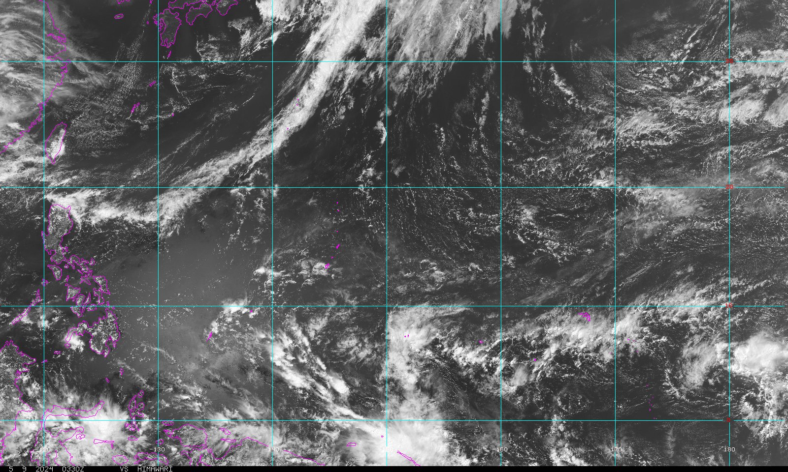
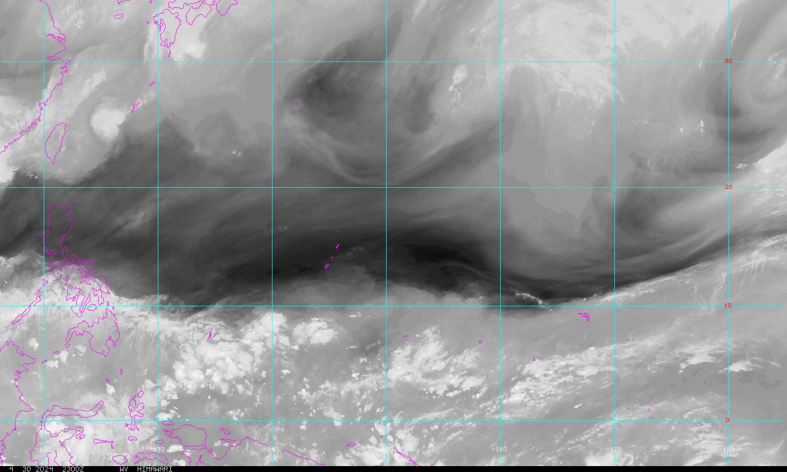
Aust and SP Links (P)
{F}:
[FMS]: Summary; [
CIMSS]:
Satellite: ( WV,
IR,
Enh);
[JTWC];
[ BoM Qld];
[BoM NT]; [ Hawaii]:
SWP
Map, SEP
Map; [ NZ Met]:
Warnings.
Aust and SIO Links (S)
{R}:
[NCMD Diego
Garcia]: Forecast, Warnings,
Satellite: Vis,
Loop, IR, Loop
; [MTOTEC]; [MMS]: TC Page; [JTWC]; [ Hawaii]:
SIO
Map; [BoM WA ];
[BoM
NT].
NIO Links (A)
(B):
[IMD]: Track, Warnings;
[JTWC];
[ Hawaii]:
NIO
Map; [ CIMSS]:
Satellite: ( IR,
WV,
EIR);
[Thai Met]: Radar, Warnings, Satellite.
NCP and NEP Links (C)
(E):
[JTWC]; [
Hawaii]:
NEP
Map.
ATL Links
(L):
[ Hawaii]:
Atl
Map; [NHC].
2004 HIGHLIGHTS: (Links to significant weather events of 2004 and earlier years)
Comparison Table of Typhoon, Hurricane and Tropical Cyclone Warnings and Signals.
Links content is updated frequently. Page content
updated 2005-05-02 at 21:10 HKT [UTC+8].
In title lines of NWP systems,
[NAME] means PAGASA name, (nnW) indicates JTWC No, and {nnnn} indicates
JMA No.
In title lines of SH systems, (nnS) or (nnP) indicates
JTWC No, {nnF} indicates FMS No, and {nnR} indicates Reunion No.
SH
details from Carl's Current
Tropical Cyclone Information page. - Phil.
2002-10-03 \file0223_files\fpcount(1).gif)
NOTE: If you know of any links which you think should be added to this page, or if you find that some of the links on this page do not work, or if links now lead to unsuitable content, please email me at smithp AT ics DOT edu DOT hk to advise me of the details.
This page was last updated 23/02/05 at 21:16:47 Hong Kong Time.
You are visitor number \file0223_files\fpcount(2).gif) (total hits to all pages in this web-site) since 24th June 1997.
(total hits to all pages in this web-site) since 24th June 1997.
Copyright © 1996 - 2005 Phil Smith, all rights reserved. All contents in this web site are provided as is without warranty of any kind. Phil Smith expressly disclaims any liability from the use of any information in this web site.
Note: for sections of some of the pages within this site attributed to [HKO]: the links and materials provided therein are supplied by the Hong Kong Observatory and the following Notice is applicable to those sections: Copyright Notice: All weather information shown here, including but not limited to all text, graphics, drawings, diagrams, photographs and compilation of data or other materials are provided by the Hong Kong Observatory. Any reproduction, adaptation, distribution, dissemination or making available of such copyright works to the public is strictly prohibited unless prior written authorization is obtained from the Hong Kong Observatory.
Note that the e-mail address for Phil Smith (also known as
"Doctor Disk") has been changed to smithp
AT ics DOT edu DOT hk or to doctordisk AT hotmail DOT com with effect from 1st January
2005. To use these e-mail addresses, in your e-mail program's "To"
field, type out the words in blue replacing " AT " with "@" and replacing
" DOT "
with "."
so that there are no spaces. Sorry for the inconvenience, but my
junk mail had passed 1,000 items per day.
The old e-mail addresses of
smith AT drdisk DOT com DOT
hk and info AT drdisk DOT com DOT hk and
phil AT drdisk DOT com DOT
hk have all been
discontinued.
03/09/2004 \file0223_files\fpcount(3).gif)